About This Hike – A Short Introduction
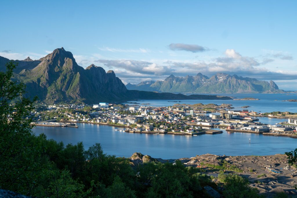
Tjeldbergtinden is a popular hike located between Svolvær and Kabelvåg in the Lofoten Islands, Norway. This moderately challenging trail offers hikers panoramic views of the surrounding landscapes, including the towns of Svolvær and Kabelvåg, the Vestfjord, and nearby mountains. It’s an excellent choice for those seeking a rewarding hike without requiring an entire day.
The hike begins from the parking area, following a well-marked trail. Initially, the path is a gravel road that gradually ascends . After walking on the gravel road for about 1.2 km you will see a wooden sign on the right side marked “Tjeldbergtinden” with an arrow pointing towards the trail.
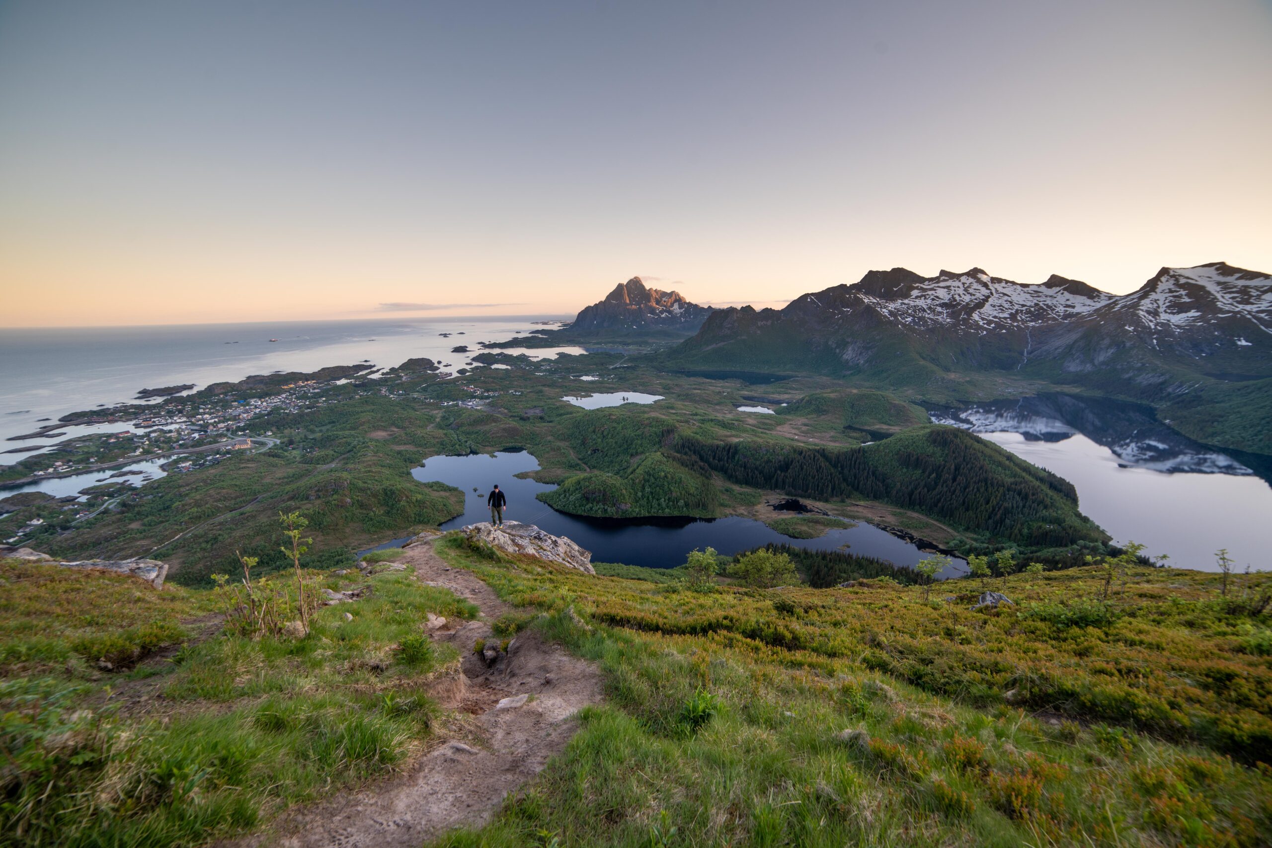
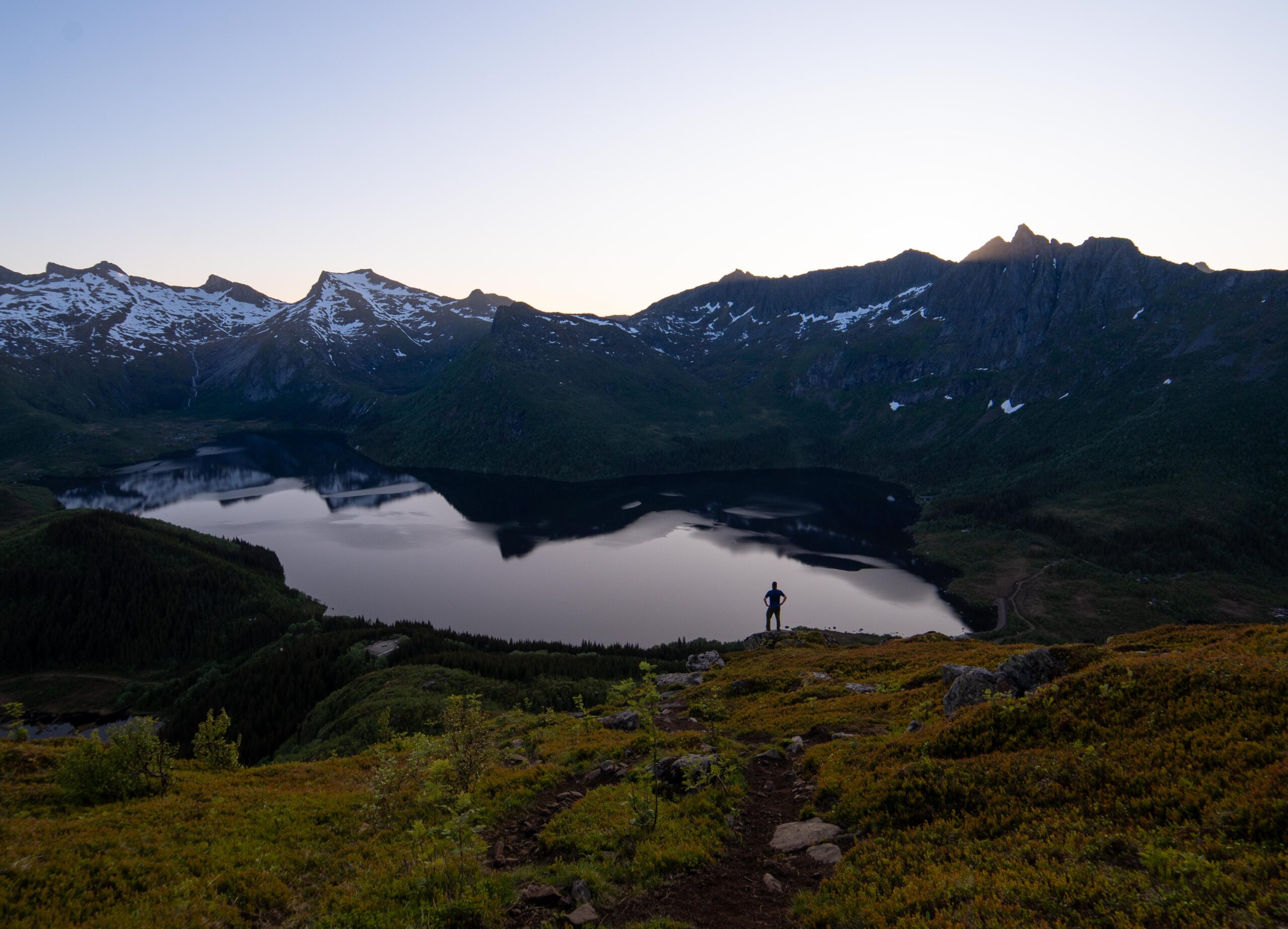
Upon following this trail, the hike first takes you through a small area with denser trees. After a short while, the ascent becomes significantly steeper. Once you have completed the steep section, you will arrive at a plateau offering stunning views of Svolvær. Even at this point, the scenery is already breathtaking.
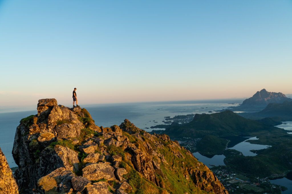
From the plateau, the final part of the hike continues towards the summit of Tjeldbergtinden. The last section before reaching the top requires some light scrambling, with a rope attached to the rock to assist hikers in climbing the steepest part. Take your time and ensure a firm grip when using the rope.
From the summit of Tjeldbergtinden, you are rewarded with a stunning 360-degree view. To the east, can you see the town of Svolvær and majestic peaks of Blåtind and Fløya standing tall in the distance. To the west, Kabelvåg is visible, nestled amidst rugged landscapes, with the impressive Vågakallen dominating the horizon.
Hike Overview – What to Expect on the Hike
Getting There & Parking – How to Get There and Where to Park
After you leave E10 and drive onto Kongsvatnveien, drive past Esso and Kiwi and you will find a parking space on the left side of the road. This is the same parking lot as for the hike to Linken.