Your guide to hiking in Lofoten
Your guide to hiking in Lofoten
Reinebringen (448m)
Medium


About This Hike – A Short Introduction
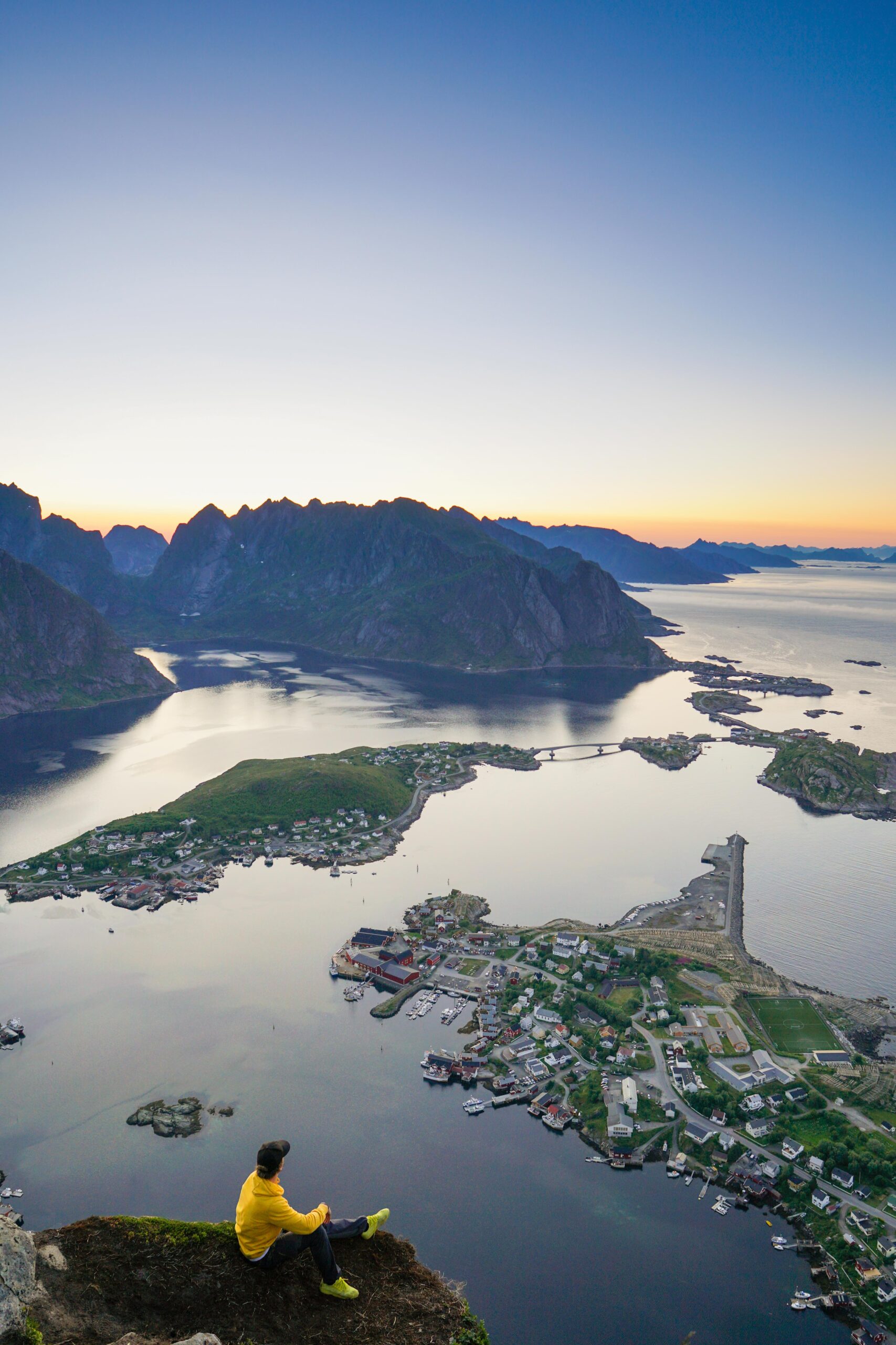
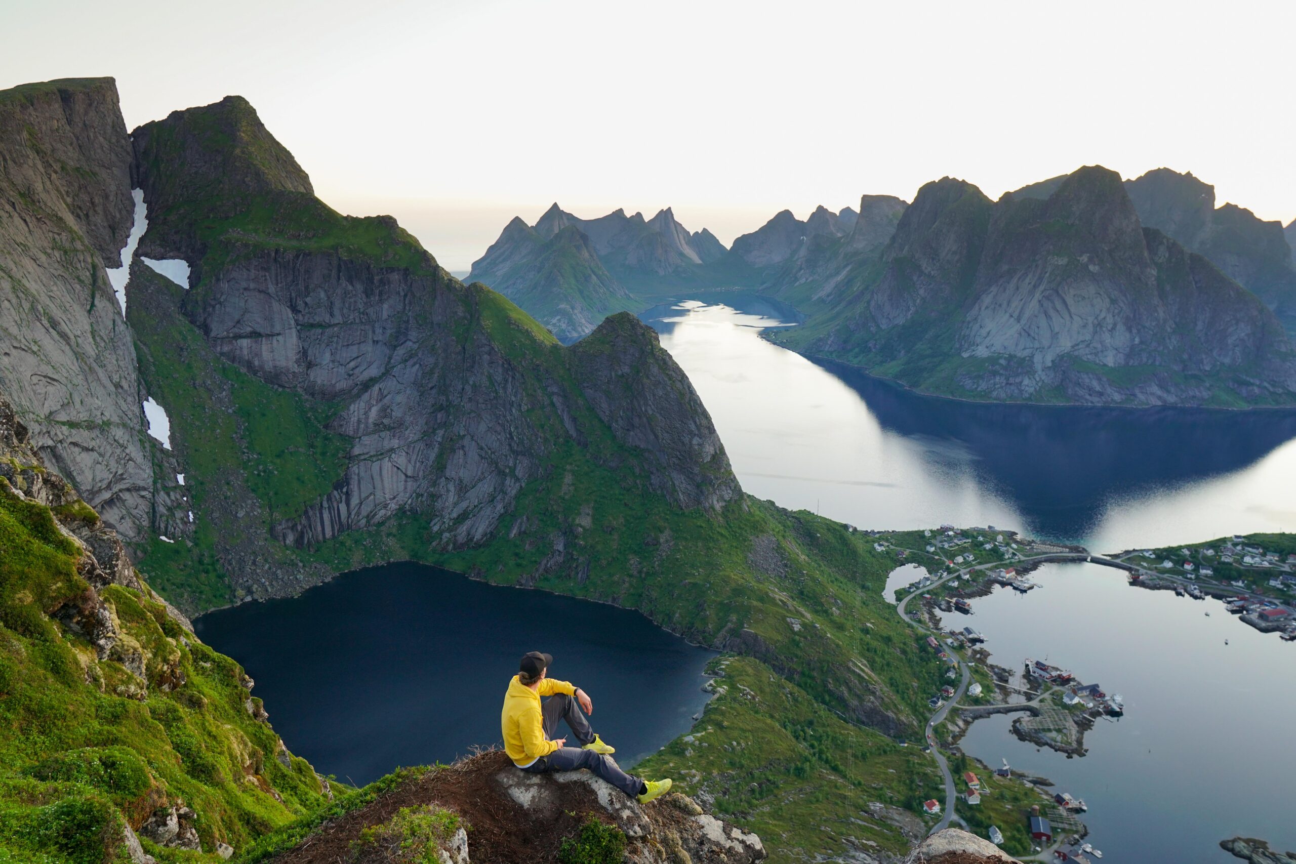
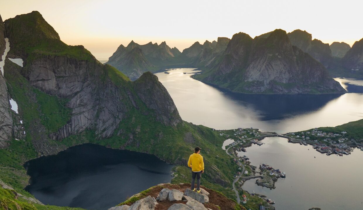
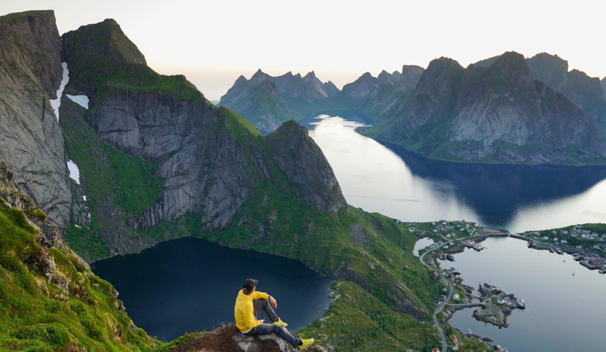
Reinebringen is the most famous hike in the Lofoten Islands of Norway, and for good reason. This 448-meter peak towers above the fishing village of Reine and offers a breathtaking panorama of deep blue fjords and jagged granite peaks. The hike’s relatively short length and spectacular summit view have made it extremely popular – over 40,000 people climbed Reinebringen in the first half of 2024 alone. Hikers are drawn to its iconic vista, which has been widely shared on social media and in travel guides. Despite the crowds, Reinebringen remains a must-do hike in Lofoten for its unrivaled scenery and memorable vantage point.
Getting There & Parking – How to Get There and Where to Park
Reinebringen is located on Moskenesøya island in Moskenes Municipality, near the village of Reine on the E10 highway.
Parking near the Reinebringen hike is limited, and there is no dedicated parking lot at the trailhead. Roadside parking on the E10 is prohibited (and enforced), so plan to use one of the official parking areas in or around Reine and then walk to the trail. Key parking options (as of recent guidelines) include:
Djupfjord/Steffenakken Viewpoint Parking: Free of charge, located ~1.3 km south of the trailhead near the Djupfjord bridge on E10. This small gravel lot is the closest parking spot, but it fills up quickly in summer. From here, you can walk along the old road parallel to the highway to reach the trail start.
Click here to find the parking lot on Google Maps.
Reine Outer Harbor (Ytre Havn): Paid municipal parking in Reine, about 1.8 km from the trailhead. Follow the signs marked “P” into Reine’s outer harbor area. Fees are around 40–45 NOK per hour (daytime rates). This large lot has ample space (including for campervans) and even offers facilities like public toilets and a motorhome waste station.
Click here to find the parking lot on Google Maps.
Reine Kultursenter (Cultural Center): Paid parking lot near the center of Reine, roughly 1.5 km from the trailhead. The fee is typically a flat 150 NOK per day, suitable if you plan to spend the whole day. It’s a convenient option if other lots are full.
Click here to find the parking lot on Google Maps.
Note: Avoid parking in unofficial pull-outs or along the main road – the local authorities frequently patrol and have placed signs and barriers to prevent illegal parking. Using the designated parking areas not only spares you a fine, but also shows respect for the small community (Reine’s municipality has limited resources and struggles with the influx of cars each summer). After parking, expect to walk 10–20 minutes along the road to reach the trailhead, so factor that into your timing.
- Distance from Leknes: Approximately 56 km (1-hour 5-minute drive)
- Distance from Svolvær: Approximately 120 km (2 hour 10-minute drive)
- Distance from Reine: Approximately 0 km
Trailhead – How to Find the Start of the Hike
The Reinebringen trail begins just outside the village of Reine, along an old bypass road on the ocean side of the E10. The trailhead is located immediately south of the Ramsvik Tunnel (the tunnel on the E10 that bypasses the coastal bend). Instead of walking into the tunnel, take the older road that curves around the outside of the mountain – the trailhead is along this stretch.
Look for a small wooden sign or an information board labeled “Reinebringen.” The most prominent landmark at the start of the trail is the stone stairway leading uphill. A bench and a small waterfall/stream are also nearby, making it easy to recognize the starting point.
From the Djupfjord/Steffenakken Viewpoint Parking: Walk north along the E10 for about 1.3 km until you reach the Ramsvik Tunnel. Before entering the tunnel, take the old road that curves around the outside of the mountain. The trailhead is located along this section, marked with a sign and the start of the stone stairway.
Finding the Trailhead from Reine: If you are walking from Reine, follow the E10 toward Å, staying on the side of the main road. Just before reaching the Ramsvik Tunnel, take the old road, leading around the outside of the mountain. The trailhead is located along this road and is easily identifiable by the stone stairway leading uphill. The walk from central Reine is about 1.3 to 1.8 km, depending on your starting point.
Hike Overview – What to Expect on the Hike
The hike to Reinebringen is a steep but rewarding climb consisting almost entirely of a stone stairway with approximately 1,970 steps. These stairs, built by Nepalese Sherpas, have made the ascent significantly safer by reducing erosion and improving footing. However, the continuous uphill climb is demanding, and hikers should be prepared for a tough workout.
Despite the short distance, the hike can feel strenuous due to the relentless incline. The steps are well-built, but they can be slippery when wet, so proper hiking footwear is recommended. There are a few resting spots along the way, including small stone benches where you can catch your breath and enjoy the view as it gradually opens up.
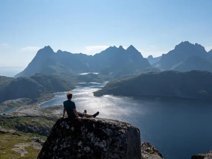
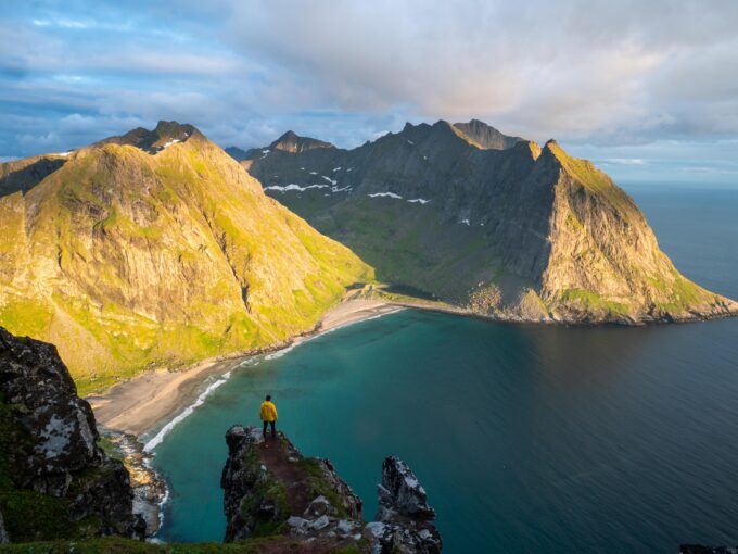
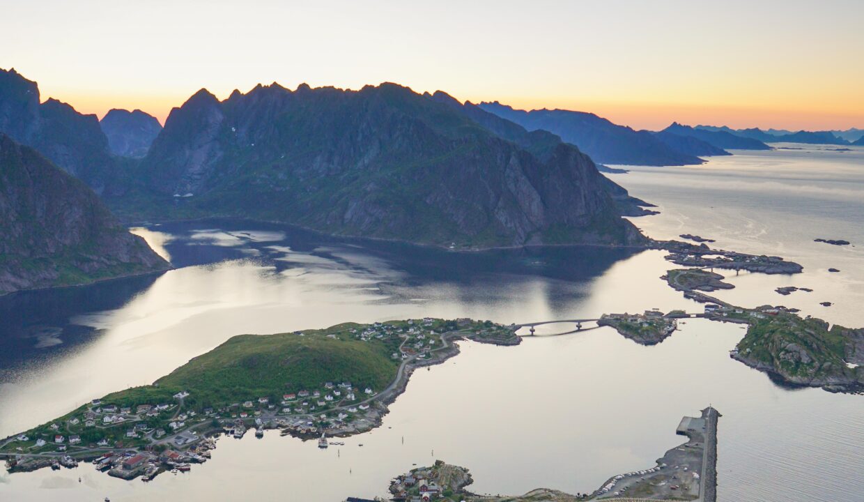
At the summit, you’ll be greeted with one of the most iconic panoramic views in Norway. The deep blue waters of the Reinefjord, surrounded by sharp mountain peaks and dotted with fishing villages, create a picture-perfect scene. Most hikers follow the ridge slightly to the left to reach the best viewpoint, which offers a clear and unobstructed look over Reine and the surrounding fjords.
The descent can be tough on the knees, so take your time and consider using trekking poles for added stability. Since the stairs are narrow, be mindful of other hikers, especially during peak season when the trail can be crowded.
Hike Map – GPX Route and Elevation Profile
Weather Forecast – Check the Weather Before You Hike

GPX Note
Please note that the GPX files provided are not 100% precise. They should be used as a general reference for guidance and not as the sole source of navigation. Always ensure to stay aware of your surroundings to ensure your safety while hiking.