Your guide to hiking in Lofoten
Your guide to hiking in Lofoten
Blåtinden (612m)
Medium

About This Hike – A Short Introduction
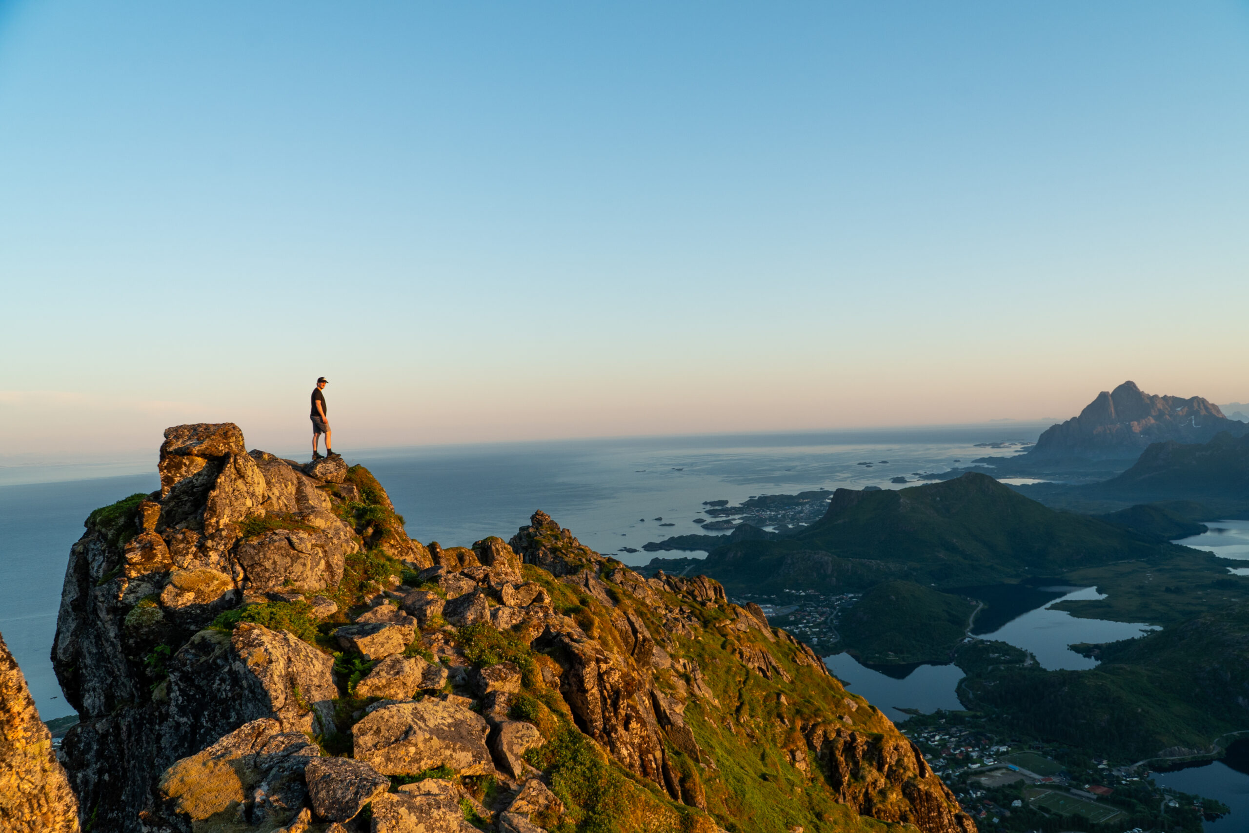
Blåtinden is the highest peak near Svolvær, rising 621 meters above sea level. It’s a moderate to challenging hike with a mix of forest paths, rocky sections, and a short, non-technical scramble to the summit. The round trip from Knutmarka usually takes 3–5 hours. The view from the top spans Svolvær, Vestfjorden, and the dramatic peaks of Lofoten.
While you can also start this hike from the Fløya/Djevelporten trailhead near Svolvær center, the route from Knutmarka (Sommartjønna) is recommended here since it’s well-tested and easier to follow.
Getting There & Parking – How to Get There and Where to Park
The most common way to reach Blåtinden is from Knutmarka, using the same parking options as for the Tuva hike:
- Closest parking: Drive up Vannverksbakken past Sommartjønna and the Red Cross cabin. Just before the road ends, turn right. After a few meters, you’ll see a small gravel area that can fit about 5–6 cars. This is the nearest parking to the trail.
Click here to find the parking lot on Google Maps.
- Larger parking: For more space, turn left at the Red Cross cabin and continue to Stranda Stadion, where there’s a large parking lot next to the football field. From there, it’s about a 5 minute walk to the trailhead.
Click here to find the parking lot on Google Maps.
If you prefer, you can also start from the Fløya trailhead near Svolvær center (by the Sherpa stairs leading to Djevelporten). We have not tested this route ourselves, so for now we recommend starting from Knutmarka.
If you’re staying in Svolvær, you can also walk to the start in roughly 30 minutes.
Trailhead – How to Find the Start of the Hike
From Knutmarka, there are two trailheads:
- Upper trailhead near the small parking: The trail starts just beyond the gravel lot at the end of Vannverksbakken.
- Main trailhead with wooden sign: From Sommartjønna, walk along Knutvikveien until the road bends. Here you’ll see a large wooden sign marked “Tuva / Blåtinden”. Turn off the road and follow the path into the birch forest.
The hike shares its initial route with Tuva, following a well-marked trail with red paint and wooden planks in the wet sections.
Alternative: It’s possible to start from the Fløya trailhead (Sherpa stairs) and link to Blåtinden from the other side, but since we haven’t tried this path, we recommend the Knutmarka trailhead.
Hike Overview – What to Expect on the Hike
From the Knutmarka trailhead, the hike begins on a forested path shared with the Tuva trail. The first section is relatively easy, following a narrow dirt track through low birch forest alongside a small stream. After around 20–30 minutes, you’ll reach Grønnåsvatnet, a peaceful mountain lake. This area has some wooden boardwalks to help you cross the wetter sections, and it’s a nice spot for a quick break.
After the lake, the trail becomes steeper and more rugged. You’ll enter denser forest and start climbing steadily over rocky, root-covered ground. Some parts can be muddy and slippery, especially after rain, so take care with your footing. Along the way, you’ll pass a small waterfall, and the sound of rushing water often follows you through this part of the hike. It’s the most physically demanding stretch of the route, but the trail is still clearly marked and easy to follow.
Eventually, you’ll emerge above the treeline onto an open mountain plateau. Here, the terrain becomes more alpine, with rocks, heather, and low shrubs. The path leads you to Tuvvatnet, a small lake nestled in the saddle between Tuva and Blåtinden. This is where the trail splits – the left path leads to Tuva, while the right path climbs toward Blåtinden.
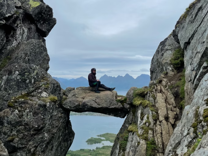
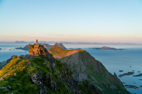
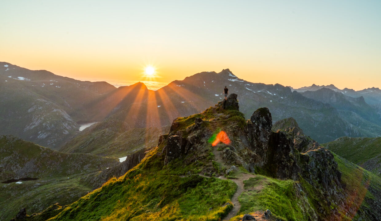
The final part of the hike is the most dramatic. As you gain elevation, the trail turns into a rocky ridge leading toward the summit. The last 50–100 meters involve a short scramble up boulders and steep rocks. You’ll need to use your hands for balance in a few places, but there’s no technical climbing. This part is exposed in places, with steep drops to one side, so caution is needed – especially in windy or wet conditions.
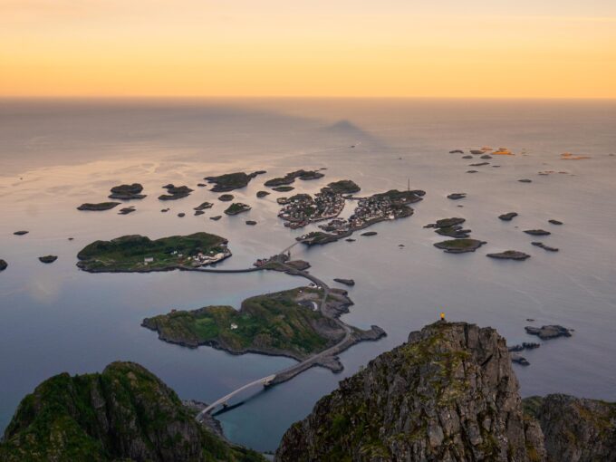
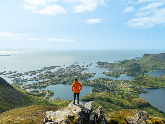
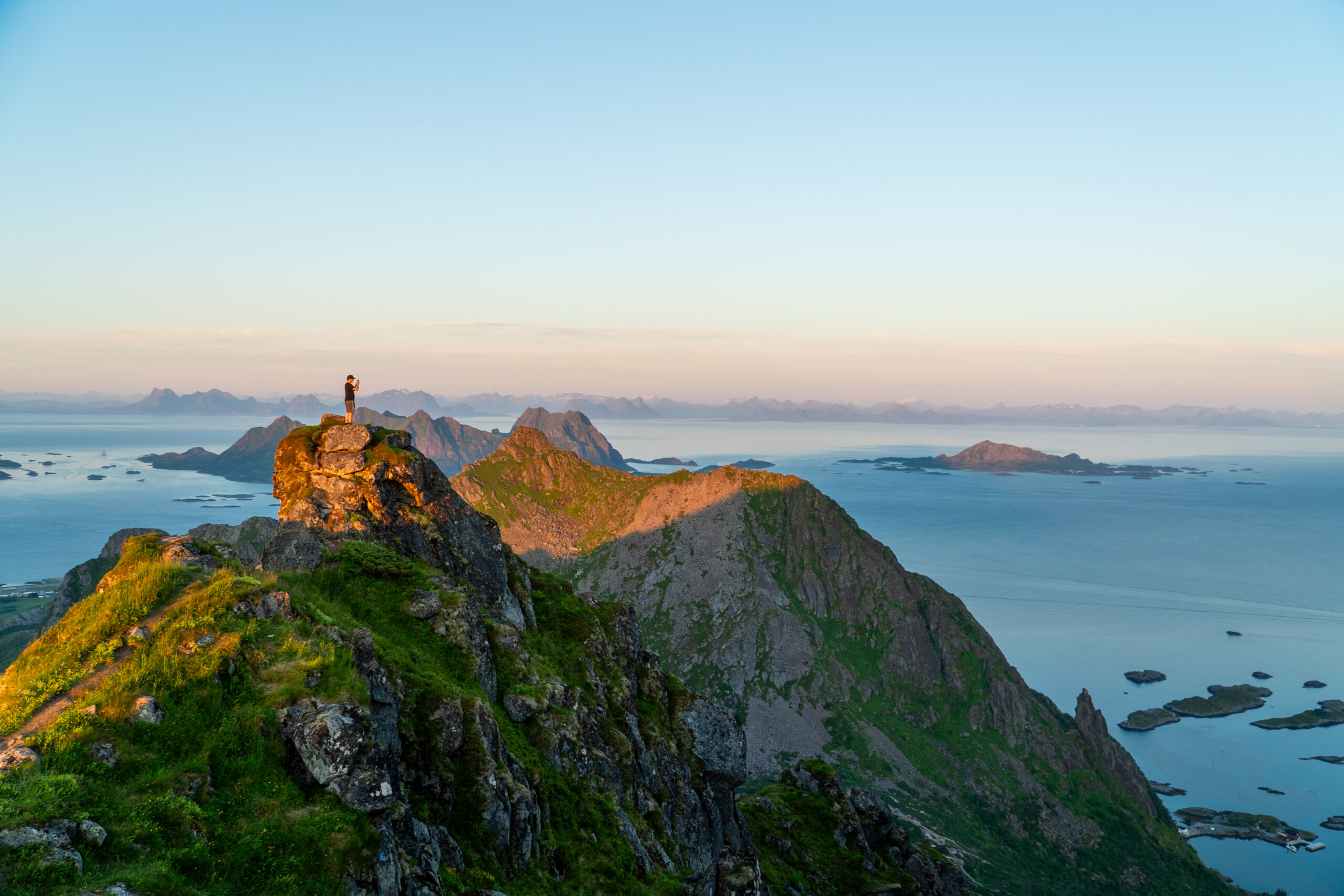
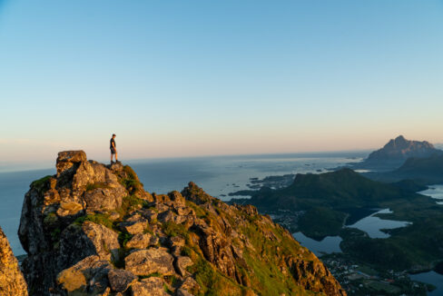
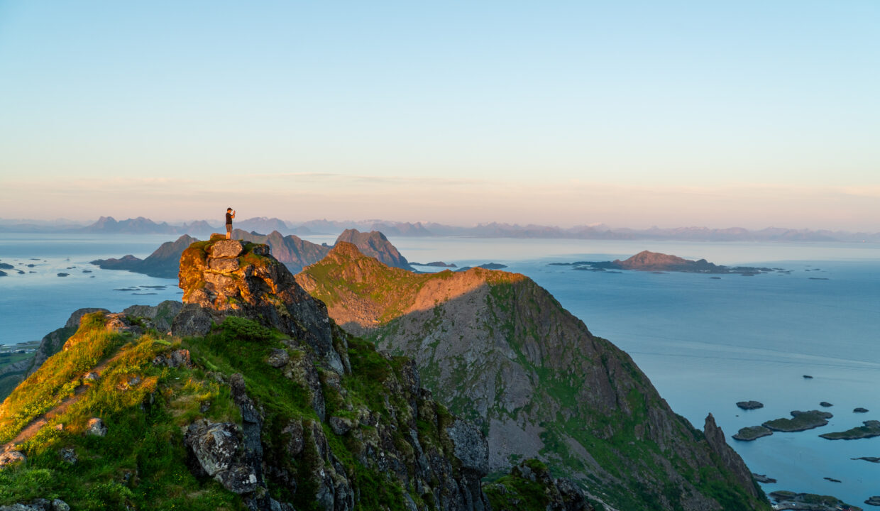
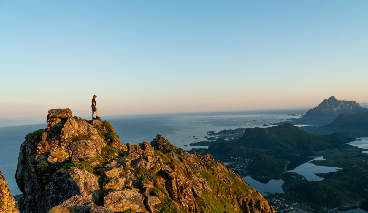
Once at the summit, you’re rewarded with a breathtaking 360-degree view. To the north, you’ll see Tuva and the trail you came from; to the east lies Svolvær and the Vestfjord; and to the west and south, the jagged Lofoten peaks stretch into the distance. On a clear day, you can even see all the way to the mainland.
Take your time at the top to enjoy the view, take photos, and have a snack. When ready, descend the same way you came. The steep sections can be slippery on the way down, so go slow and use trekking poles if you have them.
If you still have energy left, you can also combine this hike with Tuva. From the Tuvvatnet junction, it’s just a short climb to Tuva’s summit, and the trail is easy to follow. Combining both peaks makes for a longer but very rewarding day in the mountains.
Hike Map – GPX Route and Elevation Profile
Weather Forecast – Check the Weather Before You Hike

GPX Note
Please note that the GPX files provided are not 100% precise. They should be used as a general reference for guidance and not as the sole source of navigation. Always ensure to stay aware of your surroundings to ensure your safety while hiking.