About This Hike – A Short Introduction
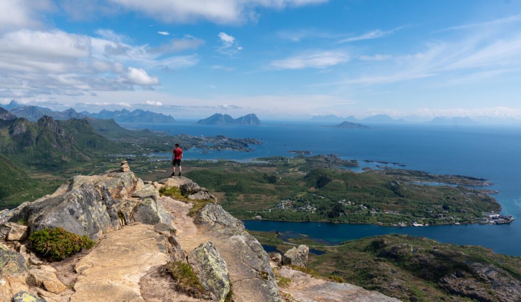
Festvågtinden (541m) is one of the most popular hikes in Lofoten, offering a breathtaking panoramic view over Henningsvær, Vestfjorden, and the surrounding peaks. The hike is short but steep, making it a challenging yet rewarding experience.
With a round-trip distance of 2.3 km and an estimated hiking time of 2–3 hours, this trail is ideal for those looking for a relatively quick yet demanding adventure. Although the hike is not long, the steep and rocky terrain makes it more strenuous than the distance suggests. Due to its popularity and stunning scenery, this trail can be busy, especially in the peak summer months.
Hike Overview – What to Expect on the Hike
The first part of the hike is steep and challenging, with an initial climb of 190 meters over large rocks and uneven terrain. This section can be tough, especially if the rocks are wet and slippery, so good hiking shoes with good grip are highly recommended.
After this rocky ascent, you will reach a small lake called Heiavatnet. At this point, turn left and follow the clearer, more defined path toward the summit. From here, the trail remains steep but easier to follow, winding uphill as the landscape opens up. Along the way, you’ll be treated to stunning views of Vestfjorden and the dramatic Lofoten peaks.
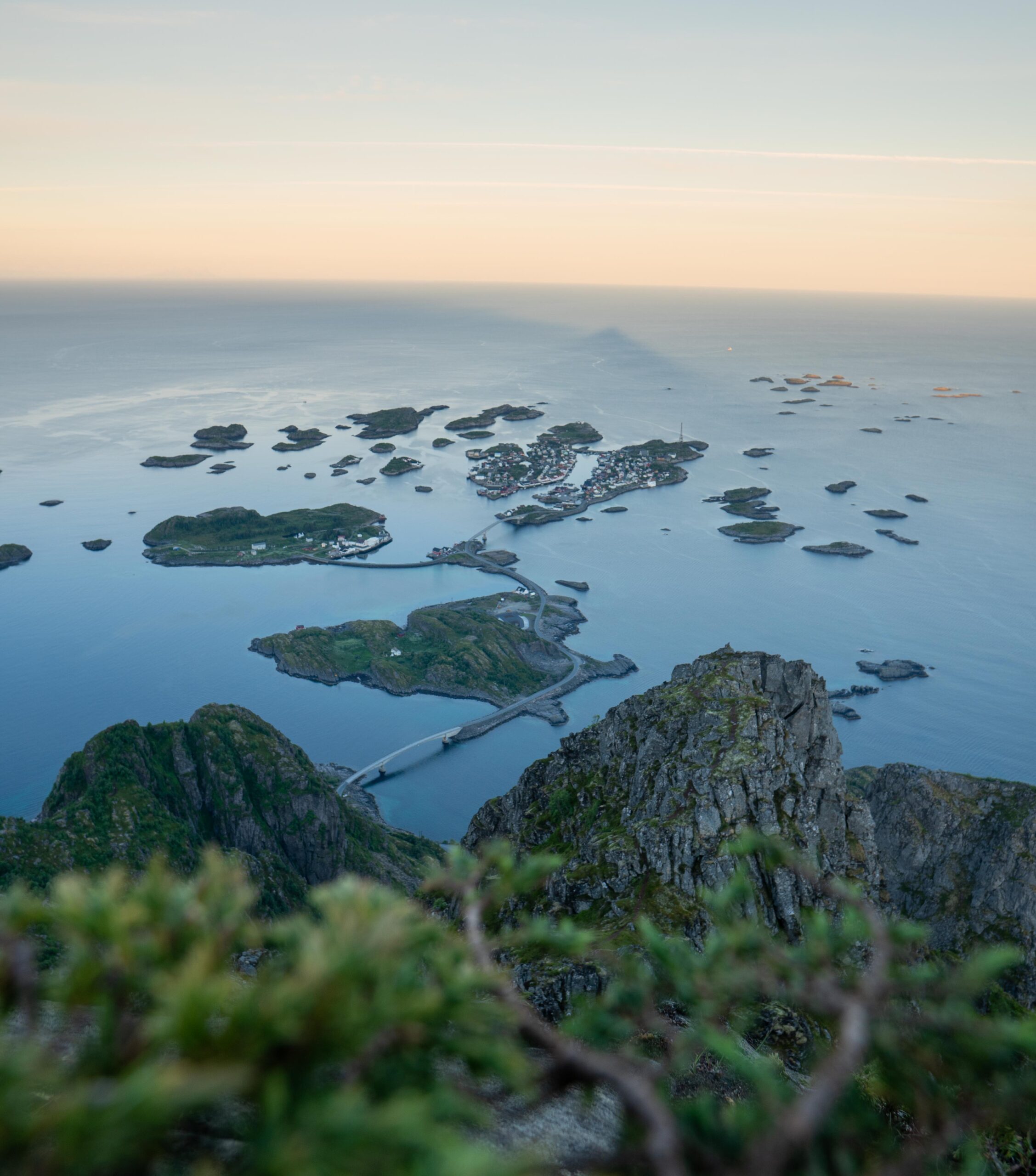
Once you reach the summit of Festvågtinden, you’ll be rewarded with an incredible view straight down to Henningsvær and across the vast fjords and towering mountains. This is a perfect spot to take photos, enjoy a break, and soak in the breathtaking scenery.
Getting There & Parking – How to Get There and Where to Park
To reach the parking for Festvågtinden, drive on the E10 highway and take the exit toward Henningsvær. Follow the road south until you reach Festvåg, just north of Henningsvær.
There are two parking lots located about 200 meters from the trailhead:
-
- The first parking lot is closer to Henningsvær, making it a convenient option for visitors coming from that direction.
Click here to find the parking lot on Google Maps.
-
- The second parking lot is slightly larger and located in the opposite direction, offering more space for those approaching from other areas.
Click here to find the parking lot on Google Maps.
Parking is free, but due to the hike’s popularity, spaces can fill up quickly. Arriving early in the morning or later in the evening is recommended to avoid crowds.
-
- Distance from Leknes: Approximately 57 km (1 hour drive)
-
- Distance from Svolvær: Approximately 21 km (24-minute drive)
-
- Distance from Reine: Approximately 110 km (1-hour 55-minute drive)
Trailhead – How to Find the Start of the Hike
From the first parking lot, walk along the road away from Henningsvær for about 200 meters until you reach a large curve in the road. Here, on the right-hand side, you will find the trailhead. The trail is well-trodden and easy to identify.
From the second parking lot walk towards Henningsvær for about 200 meters.Here, on the left-hand side, you will find the trailhead.