Your guide to hiking in Lofoten
Your guide to hiking in Lofoten
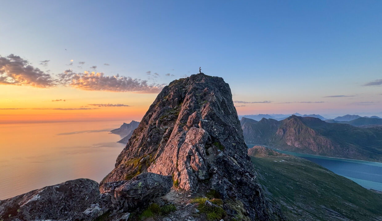
Moltinden (696m)
Medium

About This Hike – A Short Introduction
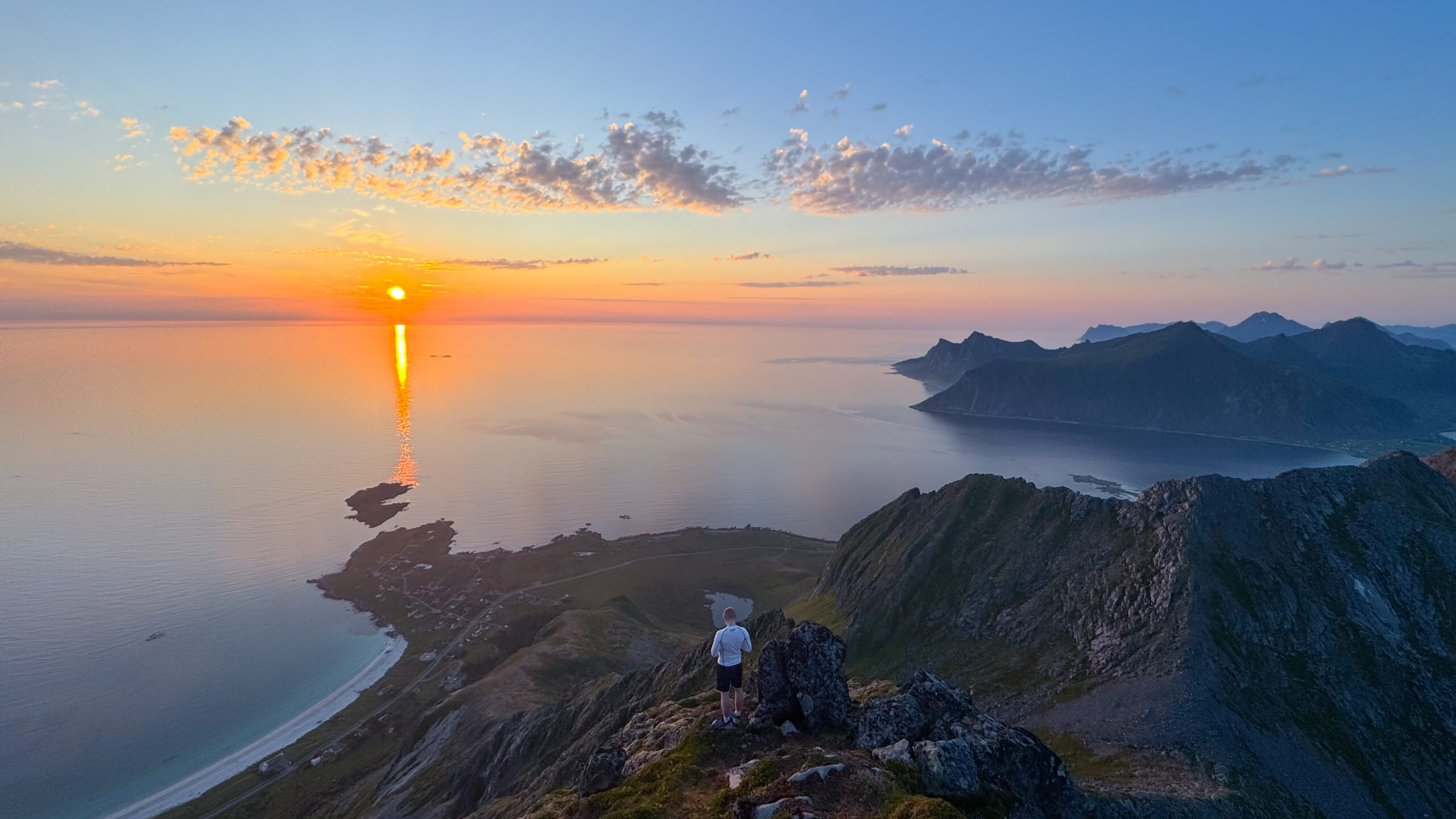
Moltinden is a stunning peak rising above Ramberg Beach on Flakstadøya in Lofoten. It stands at 696 meters above sea level and offers one of the best viewpoints in the area. The hike is short but steep, making it a great challenge for those who want a quick but rewarding adventure. The trail first takes you past Nubben, a smaller hill with its own fantastic view, before continuing up to the main summit.
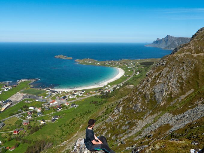
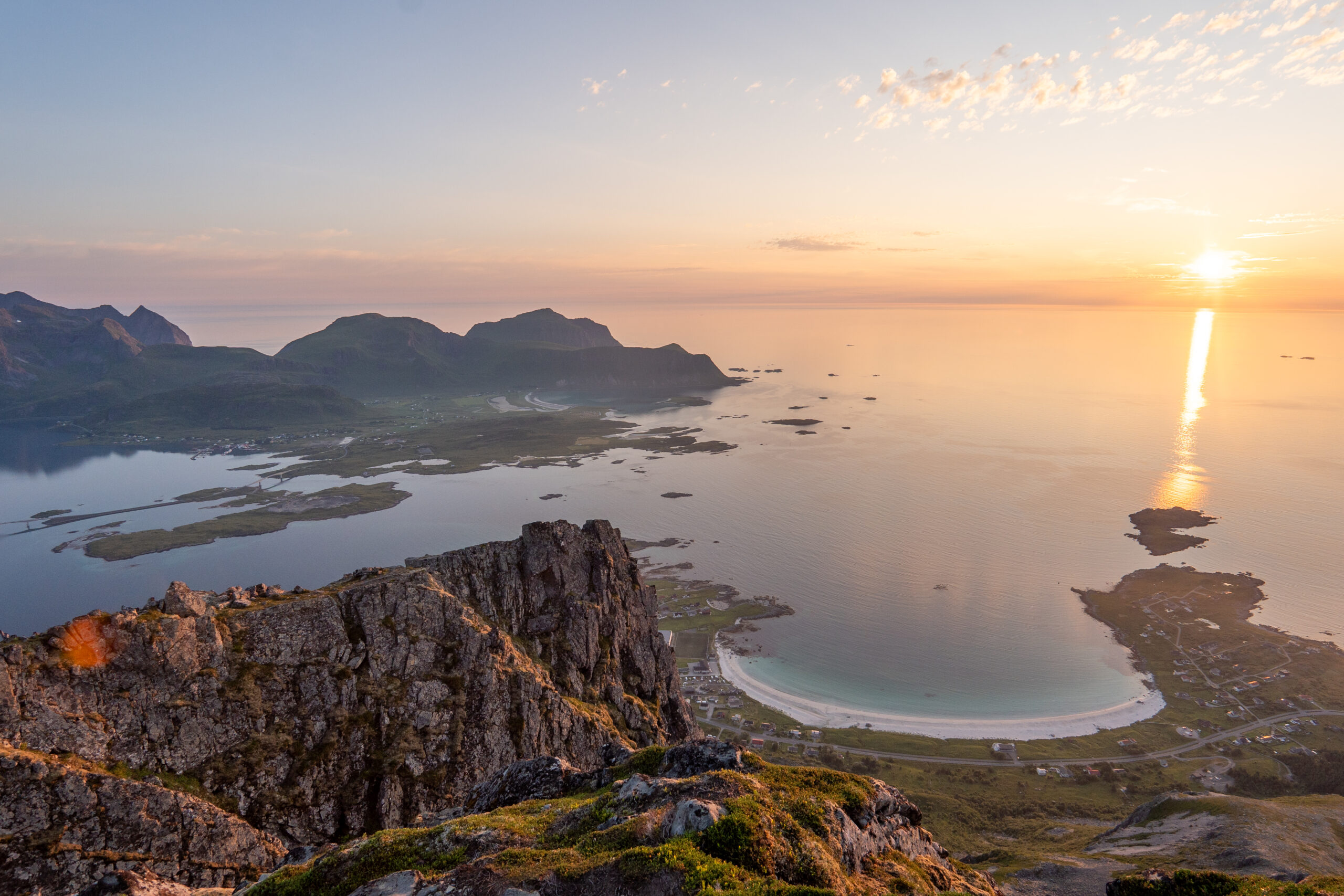
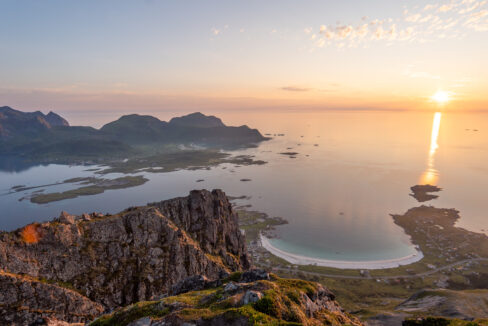
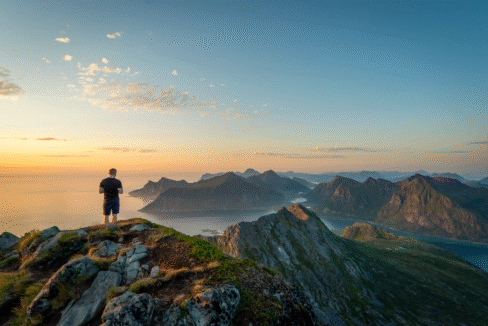
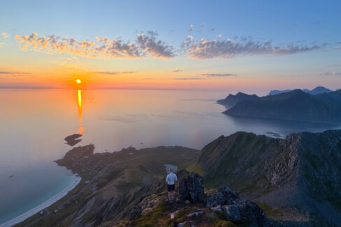
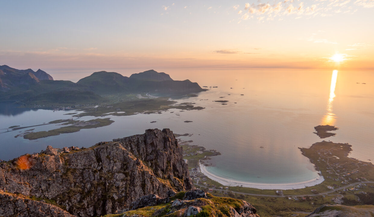
From the top, you’ll see Rambergstranda, the turquoise sea, surrounding mountains, and nearby islands. This hike is perfect for people in good shape who want a real Lofoten mountain experience in under half a day.
Getting There & Parking – How to Get There and Where to Park
To reach the start of the hike to Moltinden, drive along the E10 road to the village of Ramberg on Flakstadøya. As you enter the village, look for the Bunnpris grocery store on the inland side of the road. This is the best place to park your car, and parking is usually free. If you arrive by bus, there’s a stop right next to the store, making it easy to get here without a car as well.
This parking spot is directly across the road from the trail start and is easy to find. It’s also a great place to grab snacks or drinks before your hike.
Click here to find the parking lot on Google Maps.
Trailhead – How to Find the Start of the Hike
From the Bunnpris parking lot in Ramberg, carefully cross the E10 main road and walk toward the large white building called “U.L. Lysbøen”. Go past the building on the left side, and follow the small gravel road uphill toward the white water tank.
The marked trail begins just beyond the water tank and leads you straight up toward Nubben and then Moltinden. The path is steep right from the start, but easy to follow.
Hike Overview – What to Expect on the Hike
The hike begins with a steep climb toward Nubben (240 m). The path isn’t marked with signs, but it’s well-trodden and easy to follow. It zigzags up the grassy slope, and it’s as steep as it looks from the parking lot. After rain, the dirt can be slippery — so take your time and make sure to wear solid hiking boots. This part will definitely get your heart pumping, but you also gain height quickly.
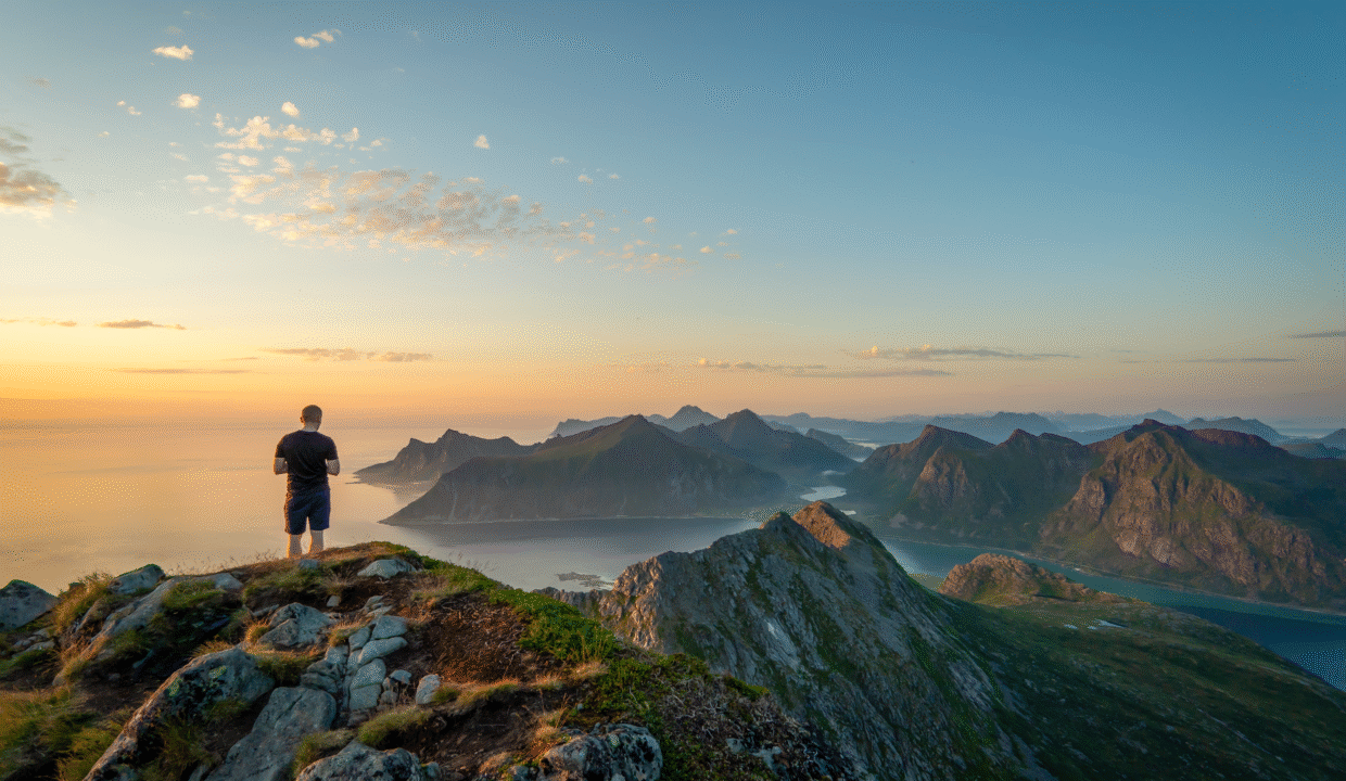
After about 20–30 minutes, you’ll come to a small trail fork. A short detour to the right leads you to the top of Nubben, a rounded hill with stunning views over Rambergstranda, the village, the Fredvang bridges, and even some distant peaks on Moskenesøya. It’s a great spot for a break and some photos.
Back at the fork, the trail to Moltinden continues left and becomes a bit wilder. The path crosses grassy slopes and turns rocky as you climb. There are a few small tracks here, so try to stay on one of the higher lines. Even if you lose the main trail, just keep heading uphill toward the ridge. The slope becomes less steep than the first section, but it’s still a good climb.
As you get higher, the views open up more and more – behind you, you’ll see the ocean, the beach, and peaks in every direction. Be careful not to get too close to the left side of the ridge, as there are some steep drop-offs. Stay slightly to the right for a safer route. The final part of the ascent has rocky terrain and boulder sections, and the trail sometimes fades, but the direction is clear: up.
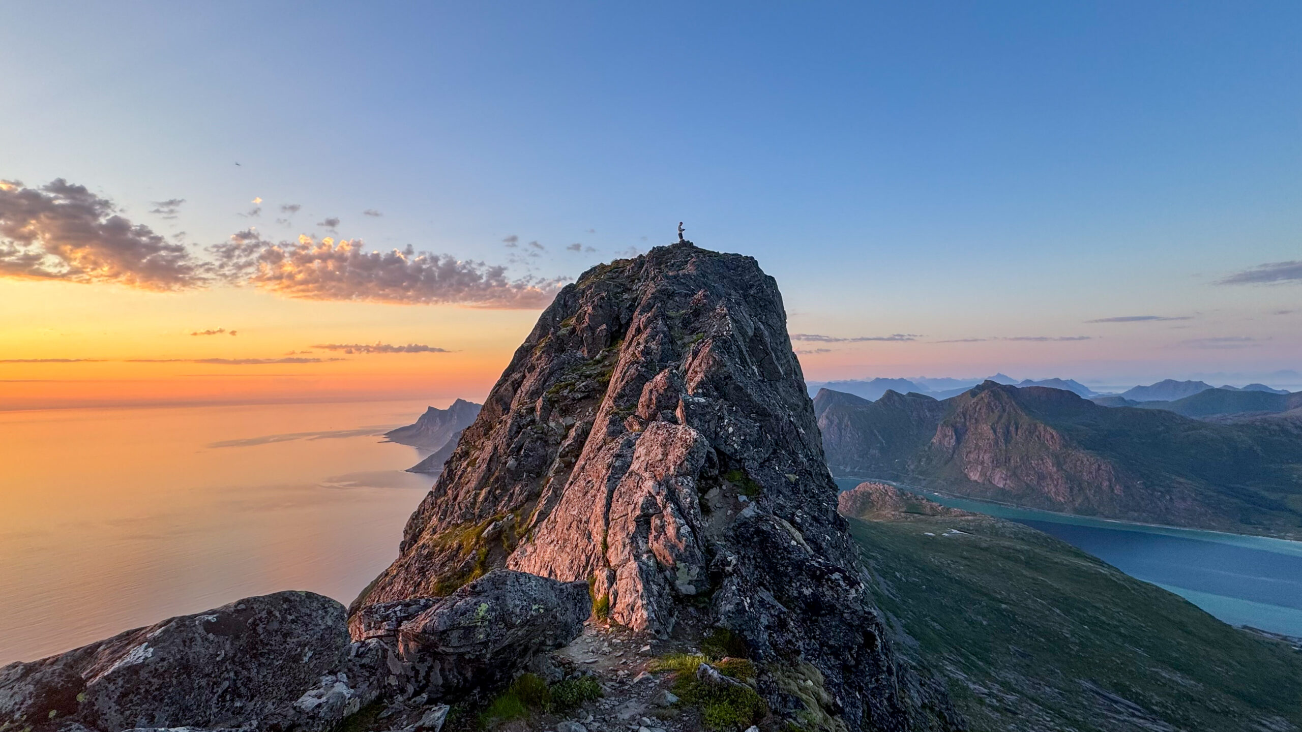
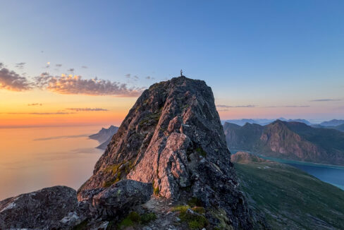
Near the top, you’ll reach the summit ridge, just below the highest point. To reach the true summit of Moltinden (696 m), you’ll need to do a short scramble. It’s only a few meters, but you may need to use your hands, and there’s a narrow section with drops on both sides. If you’re not comfortable with heights, you can stop just before this – the view is almost the same.
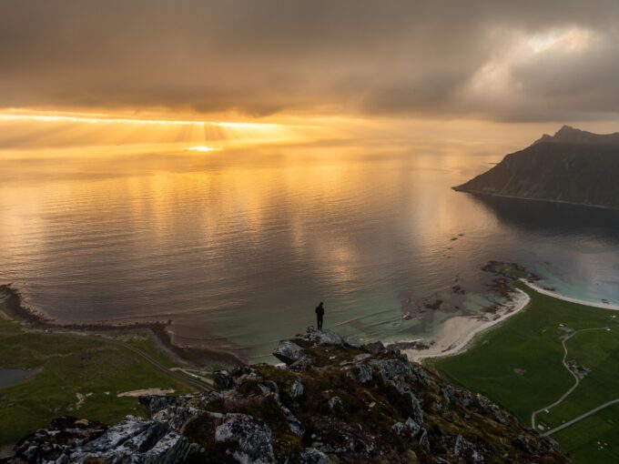
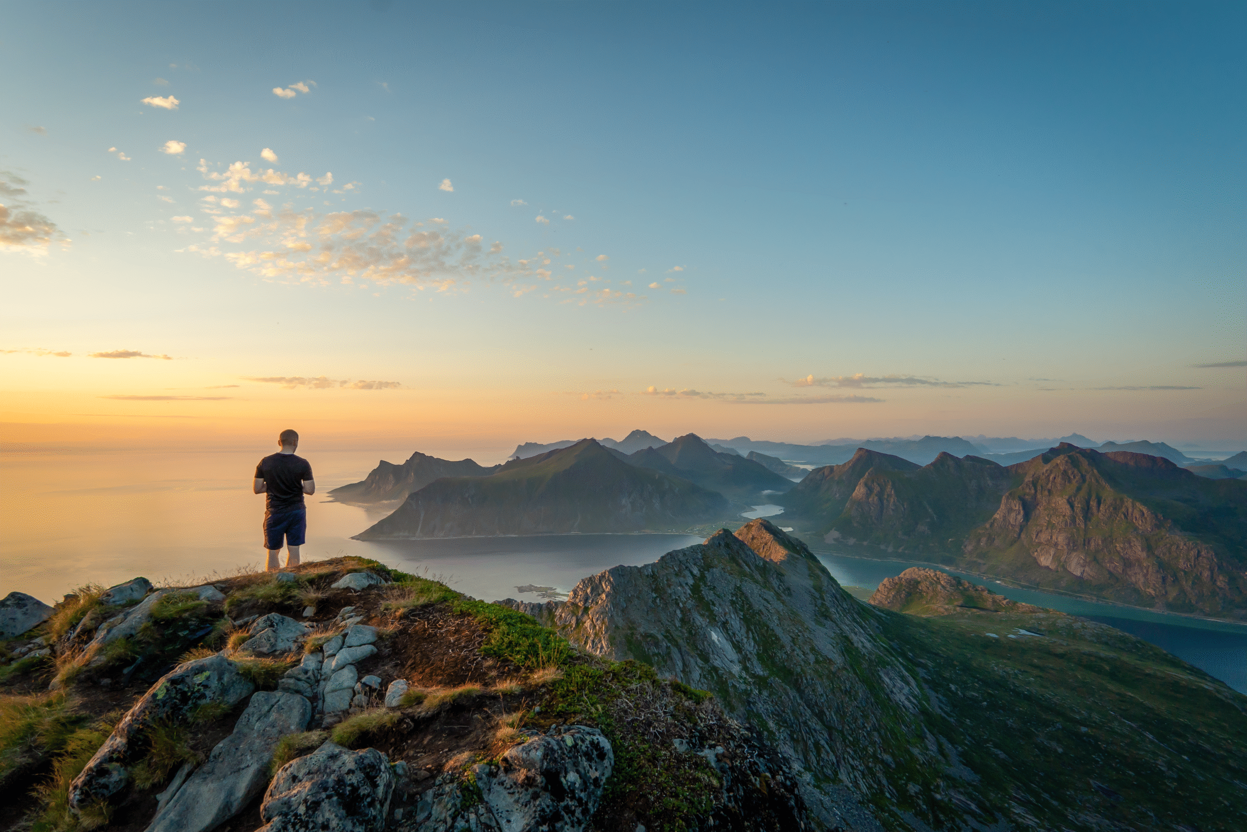
From the summit, you’re treated to a breathtaking 360° view. Far below lies Ramberg and its brilliant white-sand beach. To the north and west, you’ll spot turquoise bays, the iconic Fredvang bridges, and even the peaks of Moskenesøya in the distance. It’s truly one of the most impressive viewpoints in Lofoten.
You’ll head back down the same way you came. The descent can be tricky – especially in the steeper and rockier sections – so take your time and watch your step. Hiking poles can make the way down much easier, especially if the ground is wet.
In total, the round trip takes about 3 to 4 hours, depending on your pace and how long you stay at the top.
Though the hike is relatively short in distance, the steep climb, uneven ground, and final scramble make it feel like a real mountain adventure. It’s best suited for hikers in good shape who enjoy a bit of a challenge – and if that’s you, the reward is more than worth it.
Hike Map – GPX Route and Elevation Profile
Weather Forecast – Check the Weather Before You Hike

GPX Note
Please note that the GPX files provided are not 100% precise. They should be used as a general reference for guidance and not as the sole source of navigation. Always ensure to stay aware of your surroundings to ensure your safety while hiking.