About This Hike – A Short Introduction
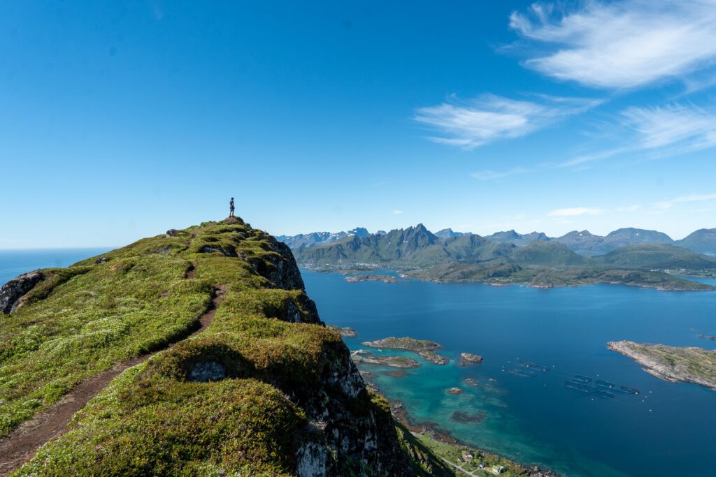
Nonstinden is a beautiful mountain near Ballstad in the Lofoten Islands. Standing at 459 meters, it offers hikers stunning views of Ballstad, the Vestfjord, and surrounding peaks. The hike is moderately challenging but rewarding, making it suitable for those with a reasonable fitness level.
Hike Overview – What to Expect on the Hike
The first part of the trail is relatively easy, but it becomes steeper as you round the ridge onto the southern side of the mountain. The path can be narrow and slippery in places, with some loose rock sections, so caution is advised.
As you approach the southern end of Ballstadheia, the trail splits into several routes. It is best to take one of the paths leading to the southeast side of the plateau. From here, continue along the eastern edge of Ballstadheia, gaining elevation gradually. The trail then turns westward and steepens towards the summit of Nonstinden. There are multiple paths leading to the summit ridge, so choose the one that best suits your comfort level.
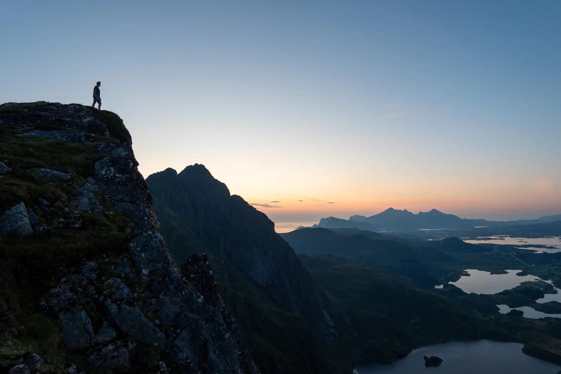
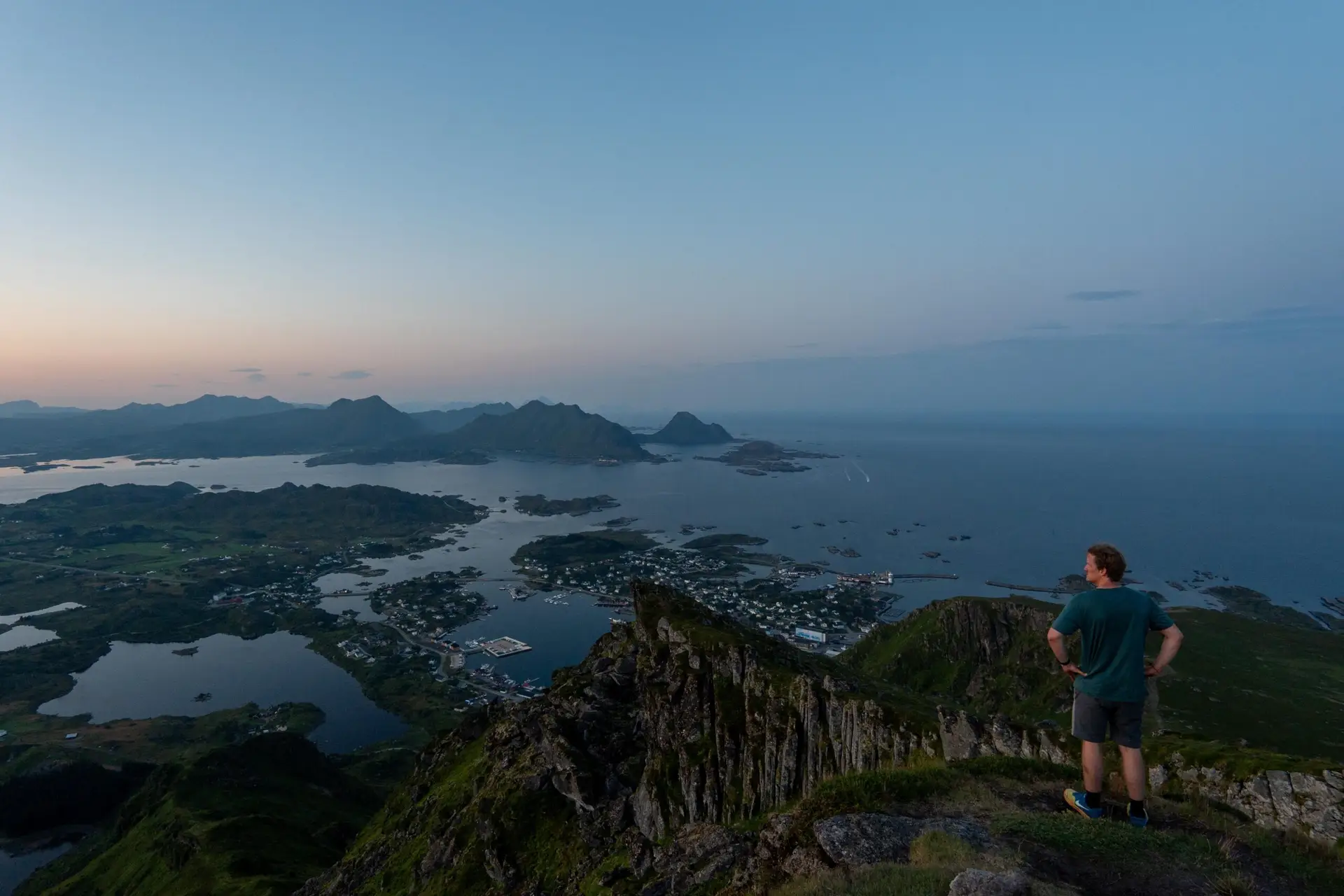
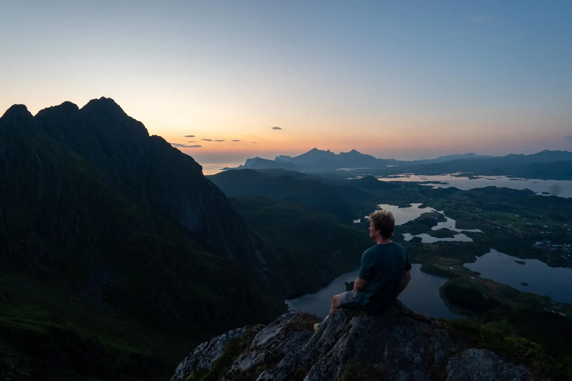
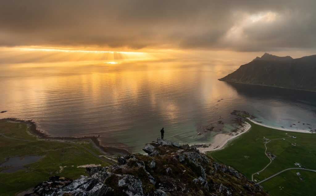
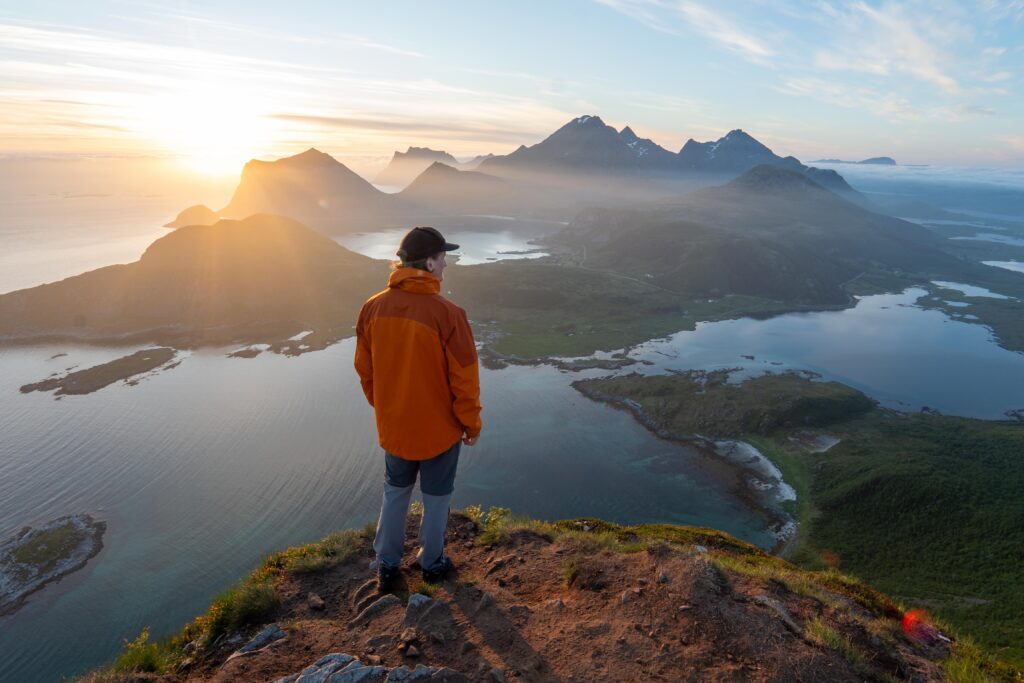
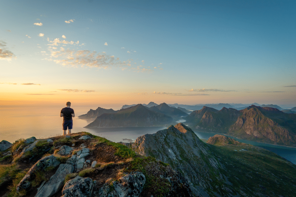
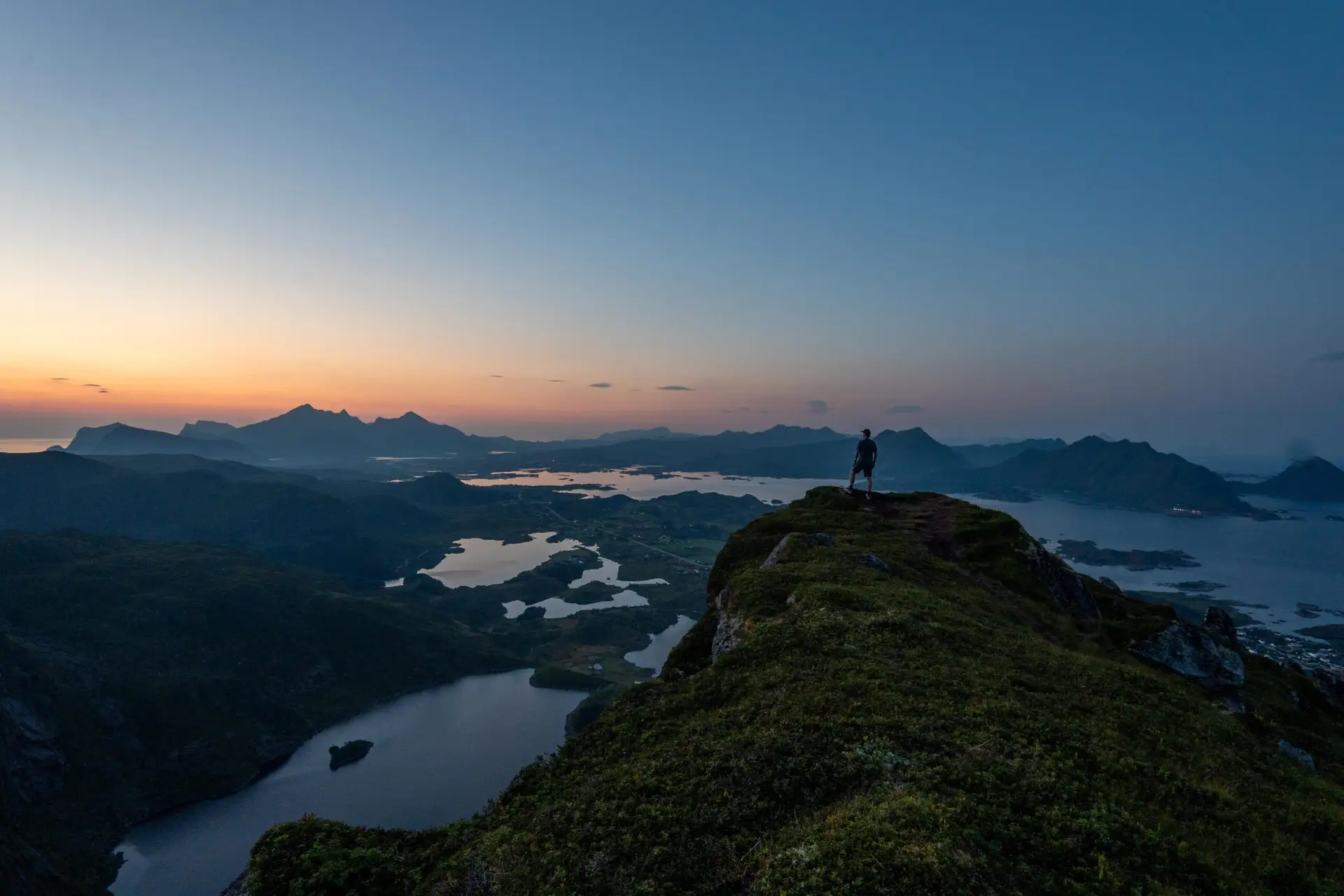
At the summit, hikers are rewarded with breathtaking panoramic views of Ballstad, the Vestfjord and nearby peaks such as Himmeltindan. The open landscape and exposed ridge make it a fantastic spot for photography, especially at sunrise or sunset.
Getting There & Parking – How to Get There and Where to Park
he road west along the harbor for about 2 kilometers until you reach Kræmmervikveien. Turn right onto this narrow road leading to Kræmmervika. After approximately 200 meters, you’ll pass a fish factory on the left as the road nears the water.
There is a small free parking area directly opposite Kræmmervika Havn, next to the harbor and close to the trailhead. However, space is very limited (only a few cars fit), so it can fill up quickly during peak hiking times. If this parking area is full, alternative options include:
Parking in Ballstad village near the grocery store or harbor area, then walking about 1.5 km to the trailhead.
Roadside pullouts along Kræmmervikveien where parking is permitted, as long as you do not block private driveways or the harbor access.
- Distance from Leknes: Approximately 11 km (15-minute drive)
- Distance from Svolvær: Approximately 80 km (1 hour 20-minute drive)
- Distance from Reine: Approximately 62 km (1-hour 10-minute drive)
Trailhead – How to Find the Start of the Hike
From the parking area, walk up the hill towards an old concrete house foundation. The trail begins here, leading past the house ruin and into a small section of forest. After about 100 meters, you will reach a well-worn path that heads south along the side of the mountain. This marks the start of your ascent.