Your guide to hiking in Lofoten
Your guide to hiking in Lofoten
Nordlandsnupen (450m)
Medium


About This Hike – A Short Introduction
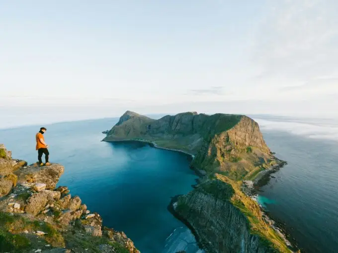
Nordlandsnupen (450 meters above sea level) is the highest mountain on Værøy and offers one of the most rewarding hikes on the island. The trail is relatively short but packed with variety: open grassy hills, panoramic ridges, and a short but exciting final section with chains to help you reach the summit. From the top, you’ll be treated to wide-open views across the ocean, the Lofoten mainland, and Værøy’s dramatic cliffs and coastline.
Getting There & Parking – How to Get There and Where to Park
Værøy is a remote island in the Lofoten archipelago and can only be reached by ferry or helicopter. The most common option is the free car ferry from Moskenes (Lofoten) or Bodø. The ferry arrives in Sørland, the island’s main village.
From Sørland, drive about 2 km northeast toward Breivika, a scenic bay on the island’s coast. Just before the road curves steeply downhill toward the beach, you’ll see a red utility building near the bend — this marks the start of the hike. There’s limited roadside parking here, enough for a few cars. Please make sure not to block driveways or gates. If the area is full, you may need to park further back and walk the last stretch.
Click here to find the parking lot on Google Maps.
Trailhead – How to Find the Start of the Hike
The trail starts right by the red building in the bend. From here, follow the visible path that leads into the hills. It begins in open grassy terrain and soon passes the remains of old stone walls and farm structures. After about 1 km, the trail reaches a small saddle with a junction — this is called Kalvskaret. Turn right here to follow the ridge toward Nordlandsnupen.
Hike Overview – What to Expect on the Hike
The hike to Nordlandsnupen is short but varied, with a total distance of about 4 kilometers round trip and around 450 meters of elevation gain. Most of the trail is moderate in difficulty, but there is one steeper and more exposed section just before the summit.
The trail starts in grassy terrain and follows a gentle incline through a valley. You’ll soon pass the remains of old stone walls and farm ruins – a quiet reminder of life on Værøy in earlier times. After a steady climb, you’ll reach a small mountain saddle called Kalvskaret, around 180–200 meters above sea level. Here, the trail splits. You’ll see a clear junction — make sure to turn right, toward Nordlandsnupen. (The path to the left leads toward Gjerdheia.)
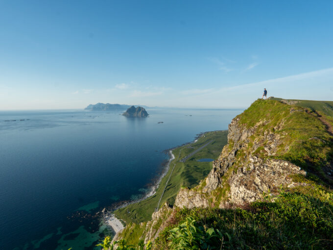
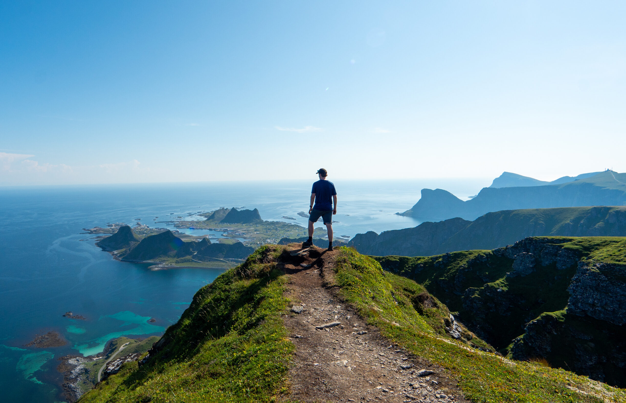
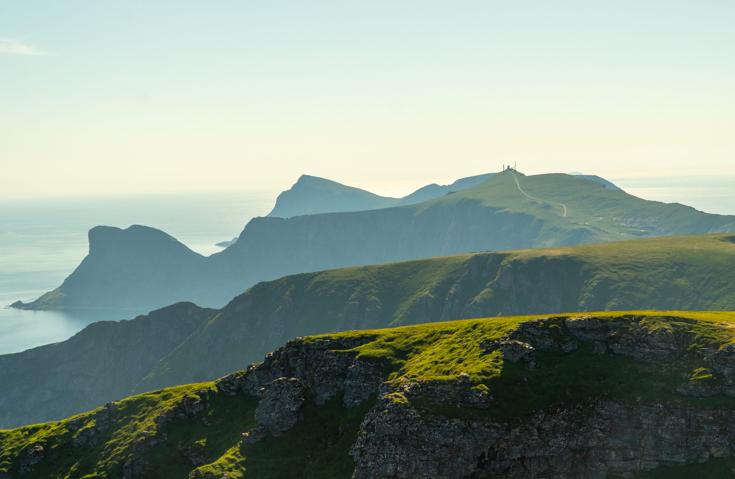
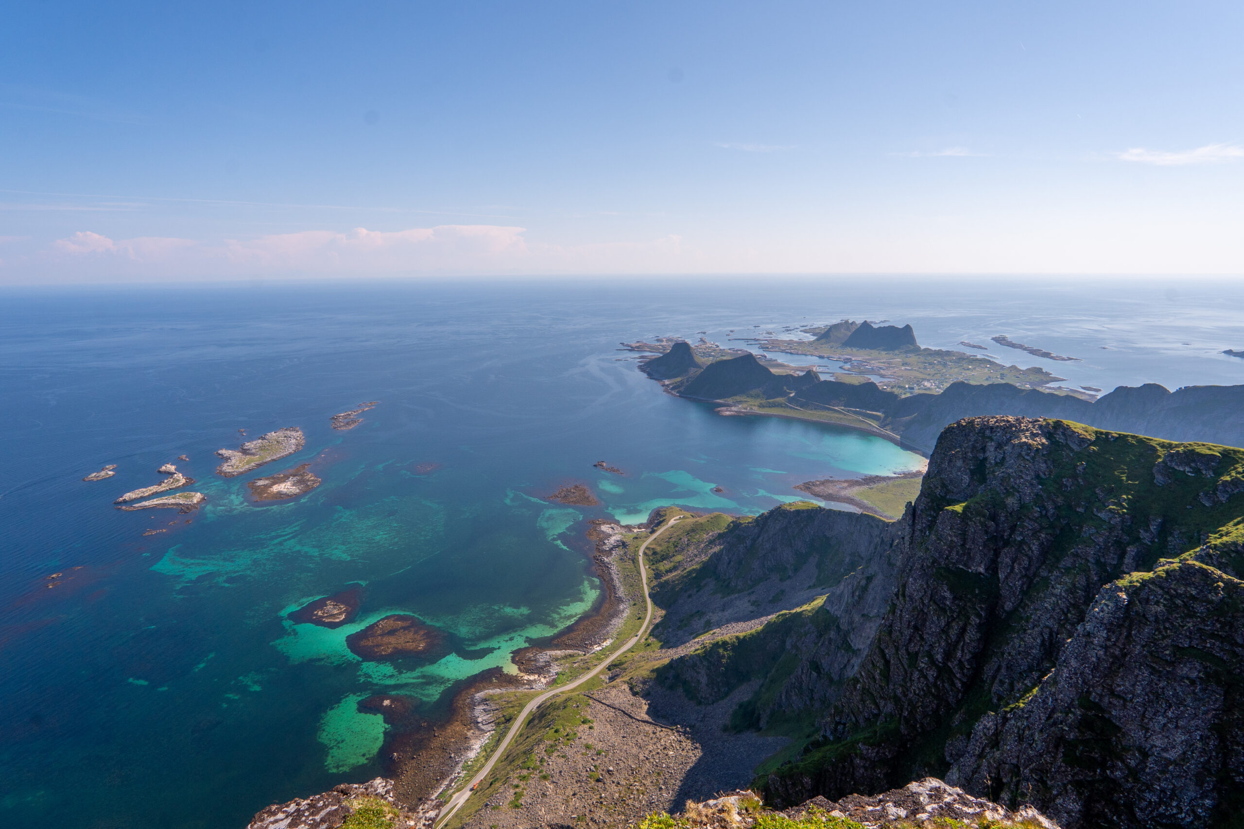
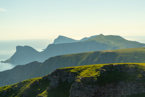
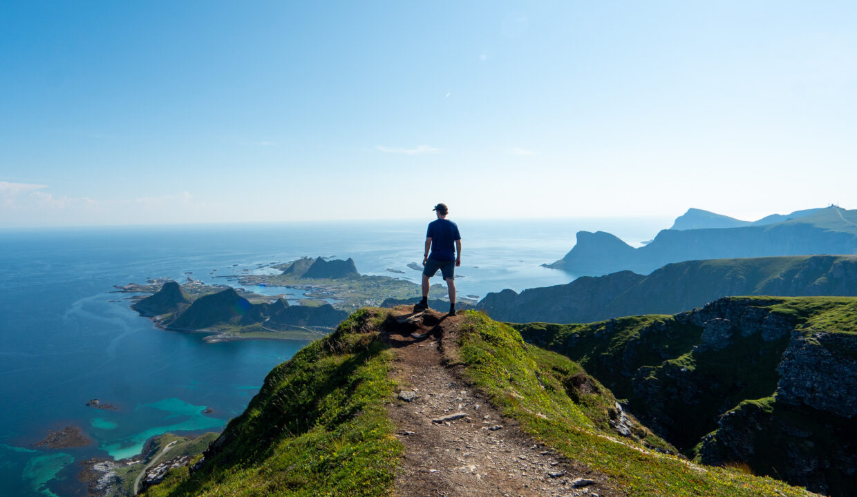
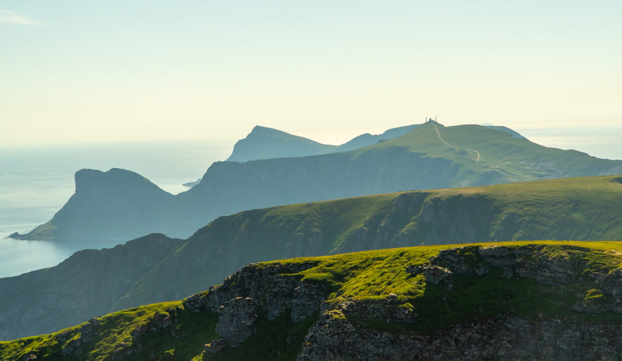
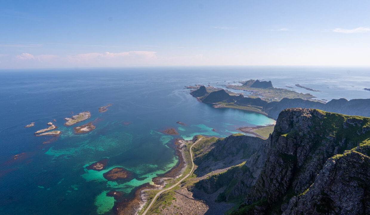
From Kalvskaret, the trail continues uphill along the ridge of Nordlandsnupen. The terrain becomes rockier but remains easy to follow. The higher you climb, the more dramatic the views become. Look around to see the coastline of Værøy open up, with the old airstrip, Nordlandshagen, and the fishing village of Sørland framed by green cliffs and turquoise sea. You may also see sea eagles soaring overhead – a common sight on this island.
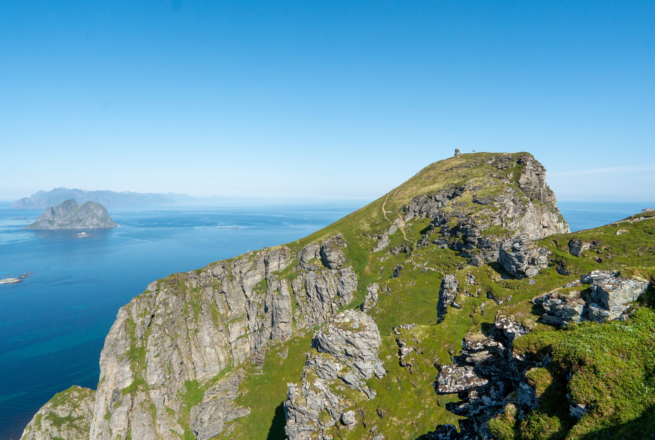
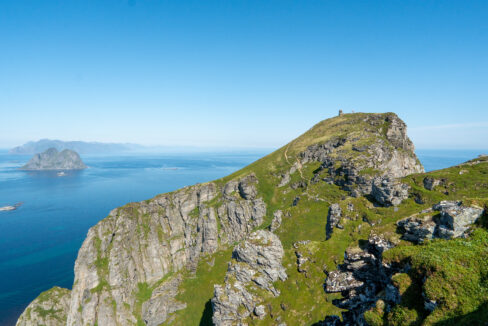
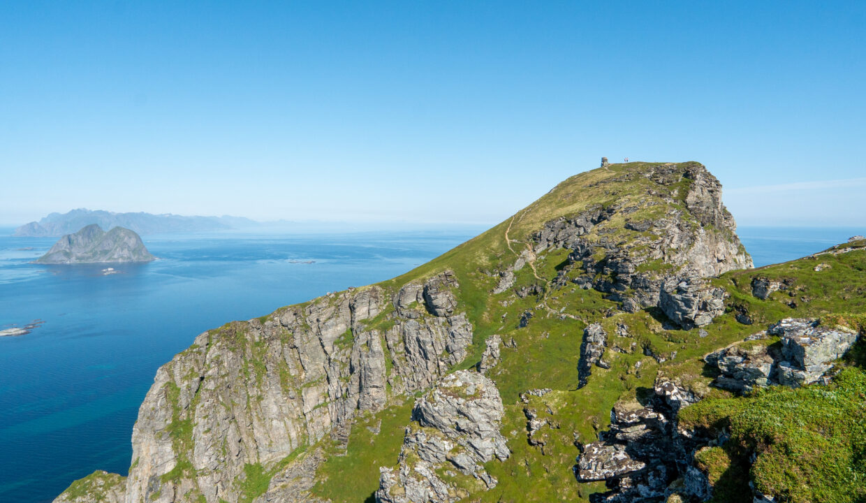
Eventually, you’ll reach a broad plateau at around 400–430 meters. This area already offers incredible views and is a good resting point. However, if you want to reach the true summit, you’ll need to continue a short distance across a more technical section. The trail narrows and leads across a short but exposed traverse, where chains are bolted into the rock for safety. Use the chains to descend carefully and then scramble up a 2–3 meter rock step with the help of another chain. This part isn’t very long, but it does require caution – especially if the rock is wet or the wind is strong.
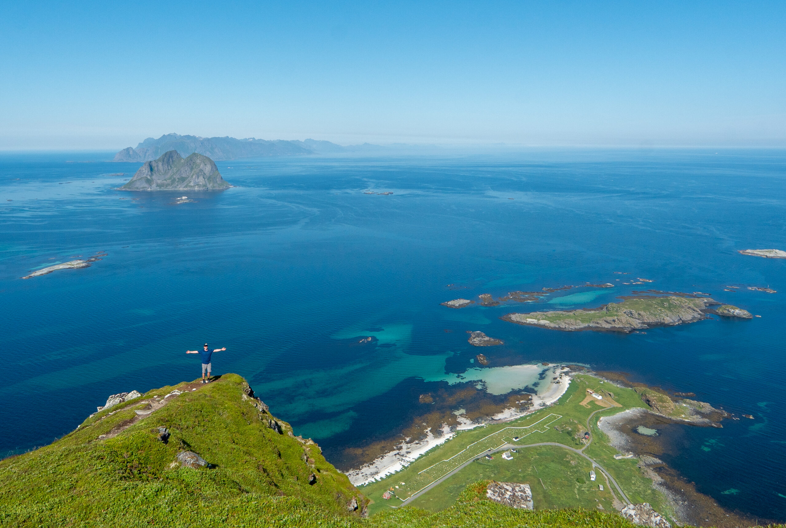
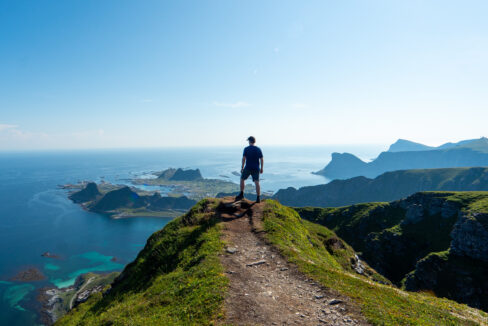
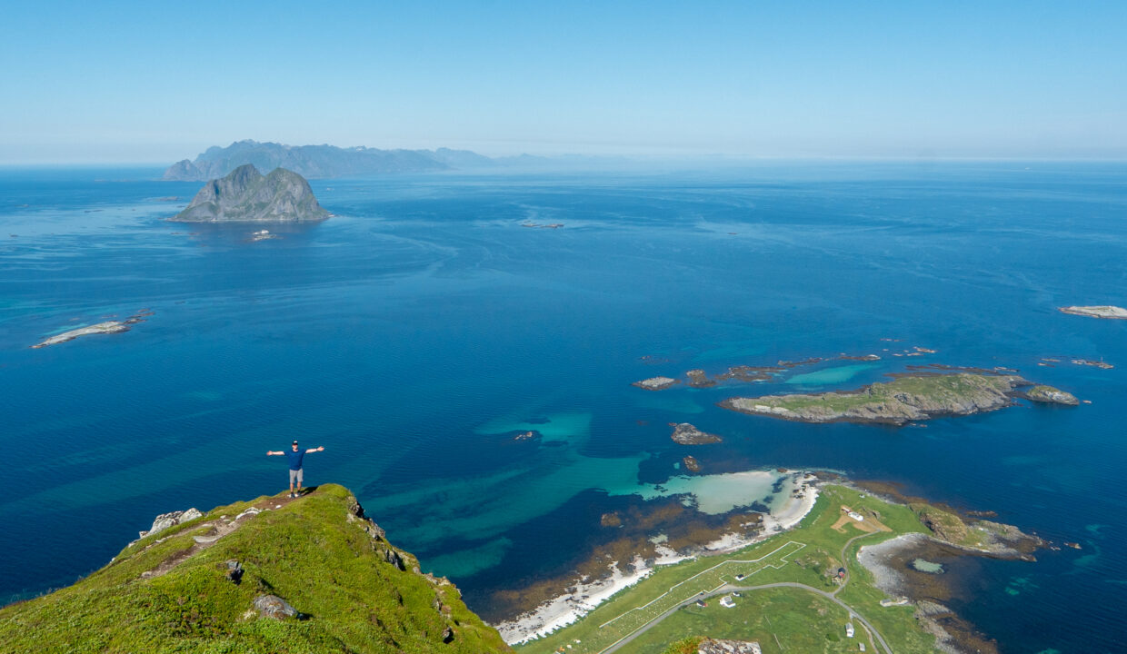
Once past this final push, the trail wraps gently around the summit ridge before leading up to the stone cairn at 450 meters, marking the highest point on Værøy. The views from here are simply spectacular. You’ll see the island of Mosken offshore, the sharp peaks of Lofoten’s mainland, and the endless sea stretching in all directions. On very clear days, you might even spot the Røst islands far to the south.
Take your time to enjoy the summit before returning the same way. The descent is faster but can be slippery — especially on grass or loose stones — so go slow and use the chains again as needed.
Hike Map – GPX Route and Elevation Profile
Weather Forecast – Check the Weather Before You Hike

GPX Note
Please note that the GPX files provided are not 100% precise. They should be used as a general reference for guidance and not as the sole source of navigation. Always ensure to stay aware of your surroundings to ensure your safety while hiking.