About This Hike – A Short Introduction
Eltofttuva is a short but rewarding hike in Lofoten, offering stunning views from the summit. This family-friendly trail is perfect for beginners or those looking for a quick and scenic adventure.
With a round-trip distance of 2.6 km and a hiking time of 1.5–2 hours, the trail is relatively easy to complete while still providing an incredible panoramic view. The well-marked path features gentle slopes with only a short steeper section near the summit, making it accessible for most hikers, including children. Whether you’re new to hiking or simply want a short and scenic trek, Eltofttuva is a great choice.
Hike Overview – What to Expect on the Hike
Eltofttuva is a relatively easy hike, making it a great option for families and beginners. The trail consists mostly of grassy terrain, with some rocky patches along the way. The ascent is gradual, making the hike less strenuous than many other trails in Lofoten.
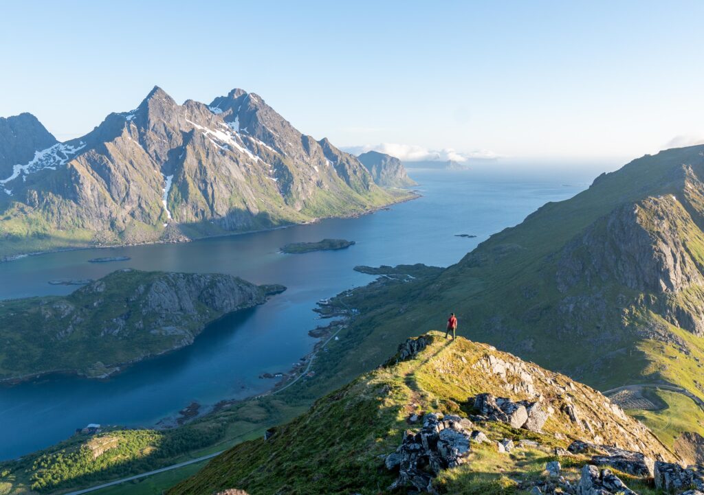
As you make your way up, the views begin to open up. You will soon reach the final stretch, which is slightly steeper but still manageable. This last section leads to the summit, where a large stone cairn marks the highest point. The total hike time is around 1–1.5 hours round trip, depending on your pace.
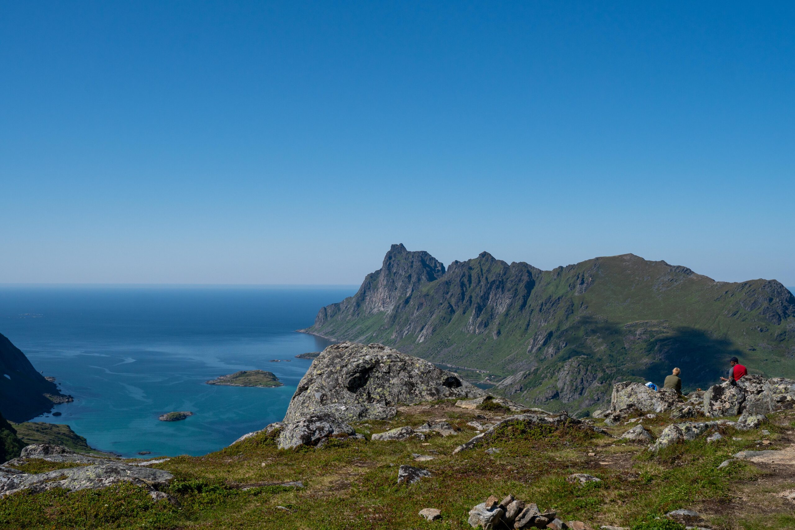
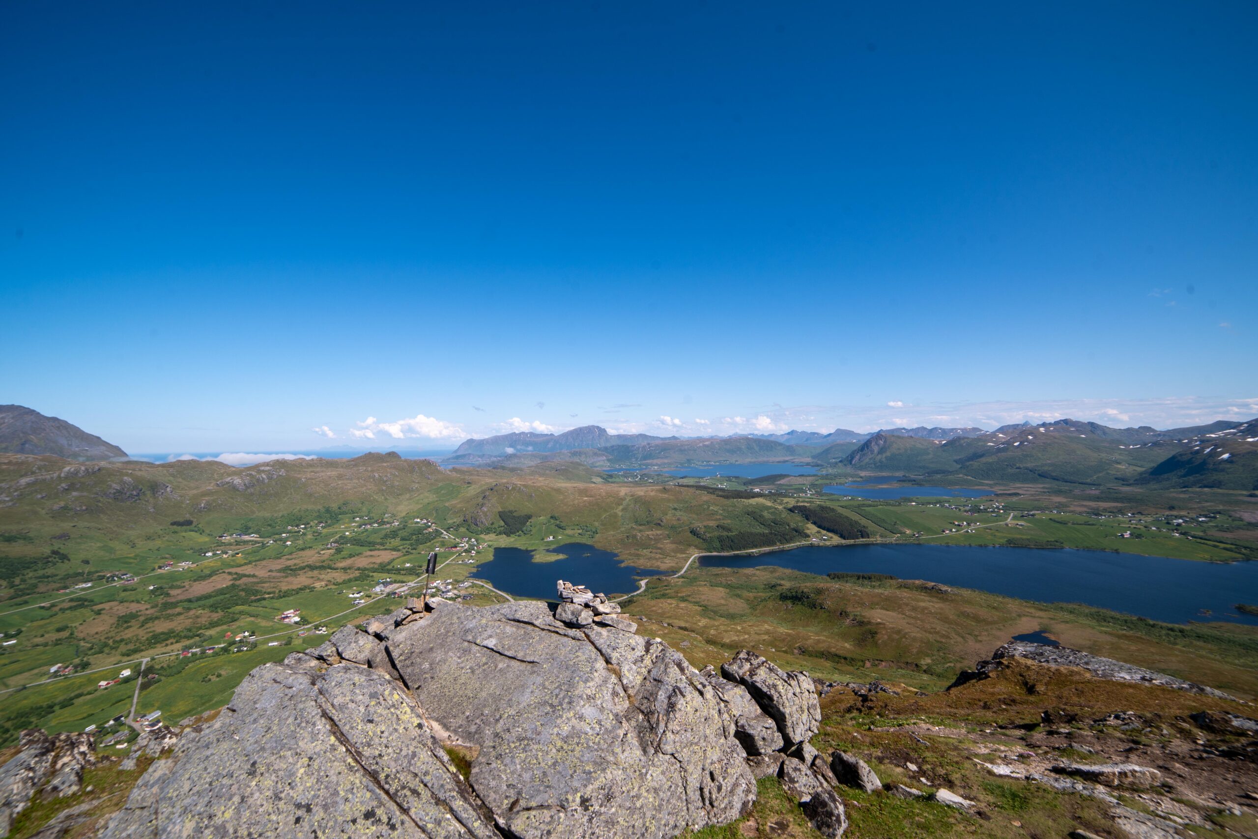
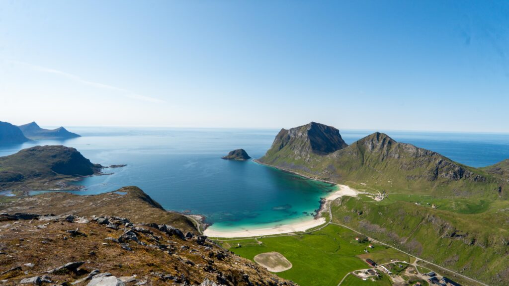
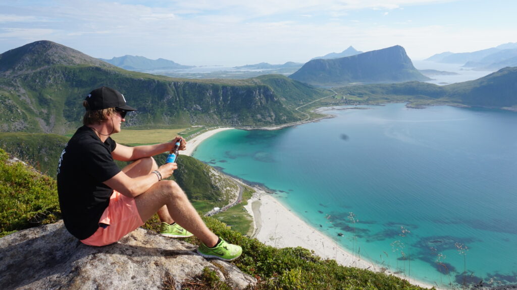
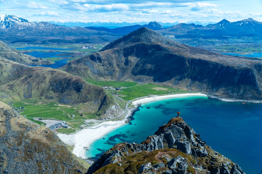
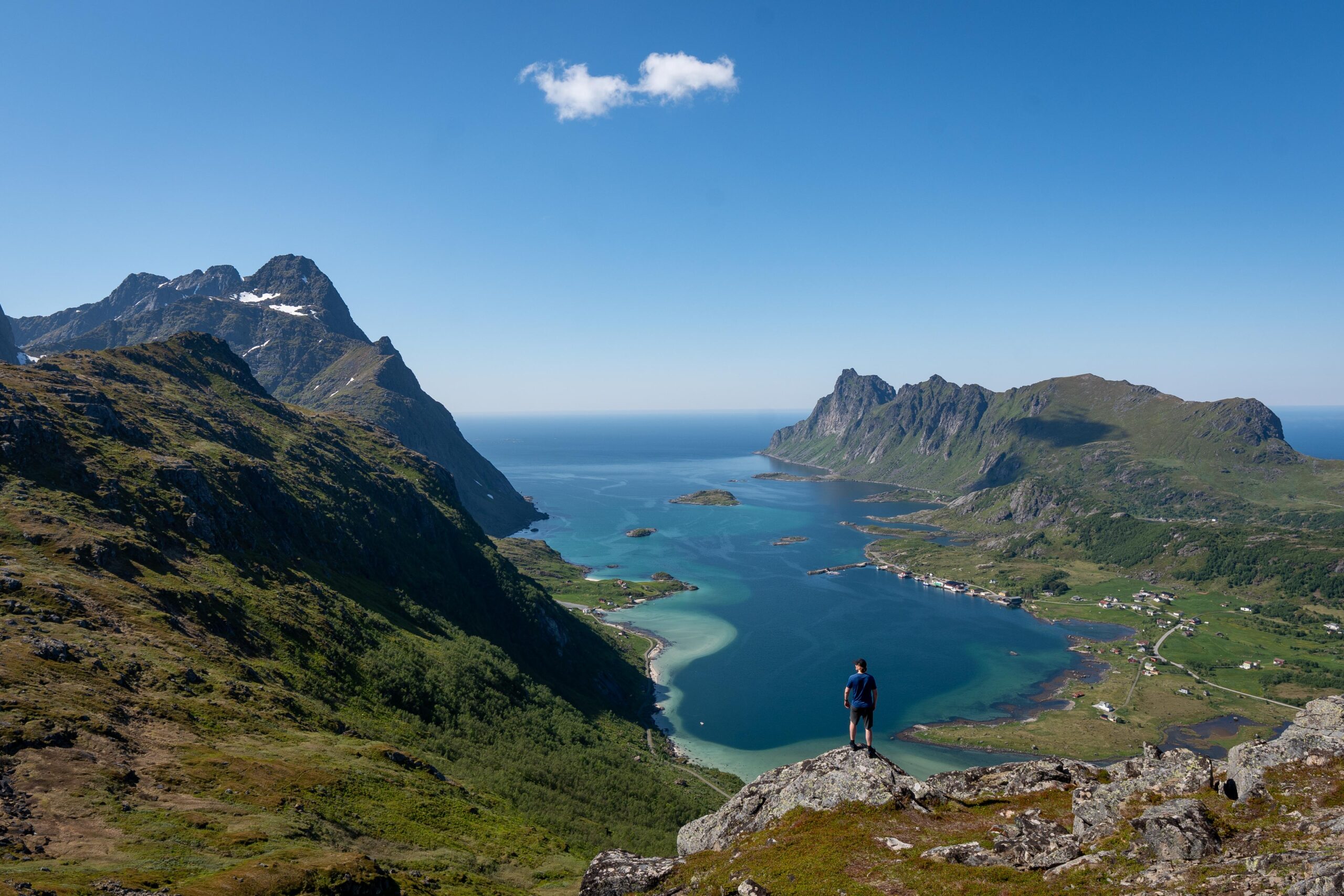
At the summit, you will be rewarded with stunning panoramic views. To the west, the majestic peak of Himmeltindan dominates the skyline, while below you, the deep blue fjords and open landscapes of Vestvågøy stretch out in every direction. This is the perfect place to take a break, enjoy a snack, and soak in the beauty of Lofoten.
Getting There & Parking – How to Get There and Where to Park
To reach the Eltofttuva trailhead, start by driving on the E10 highway and take the turn toward Unstad. Follow Steinfjordveien, the road leading to Unstad, until you reach the parking area after about 2km.
Look for a small parking lot on the left-hand side of the road, near a football field and a sign that says “Velkommen til Steinfjorden”.
Parking is free, but space is limited, so it’s best to arrive early, especially during summer when the trail is more popular. Be sure to park properly without blocking the road or other vehicles.
- Distance from Leknes: Approximately 14 km (15-minute drive)
- Distance from Svolvær: Approximately 59 km (1 hour drive)
- Distance from Reine: Approximately 66 km (1-hour 15-minute drive)
Trailhead – How to Find the Start of the Hike
The trail begins directly from the parking area, passing between a grill hut and a wind shelter. From here, follow the well-worn trail until you reach a gate. Pass through the gate, and the trail turns slightly to the right, beginning a gentle ascent toward the mountain ridge.