Your guide to hiking in Lofoten
Your guide to hiking in Lofoten
Volandstinden (457m)
Medium


About This Hike – A Short Introduction
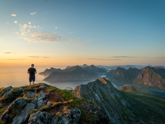
Volandstinden (457m) is one of the most scenic and accessible hikes in Lofoten, offering breathtaking 360° fjord views with a relatively short and easy trail. Despite its steep and dramatic appearance, the hike is moderate and suitable for most hikers. The round-trip distance is 4.5–5 km, taking around 3-4 hours to complete. The trail is well-worn, featuring grassy paths, some steep sections, and minor scrambling near the summit.
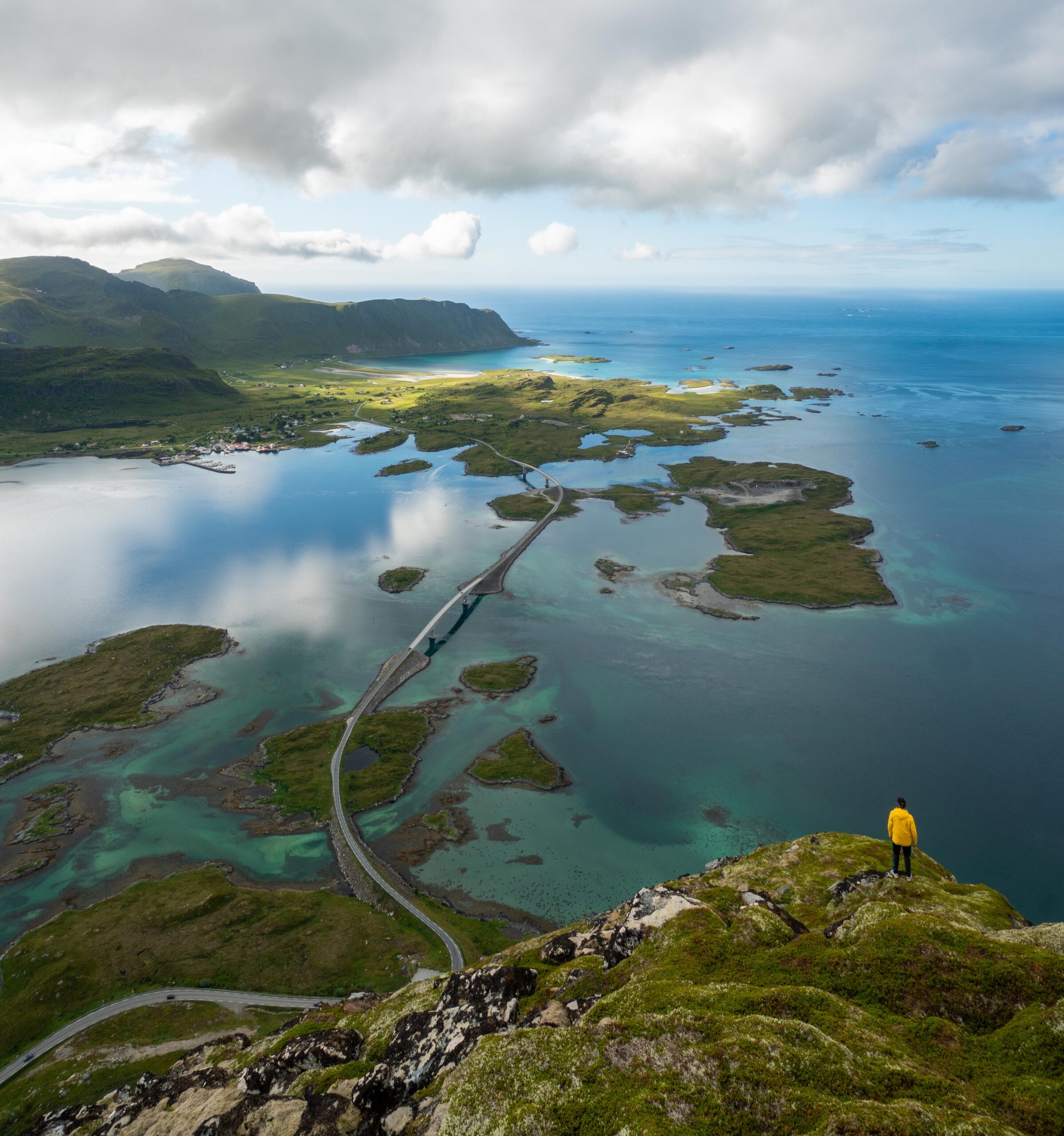
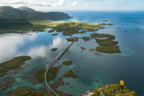
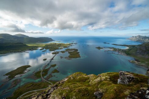
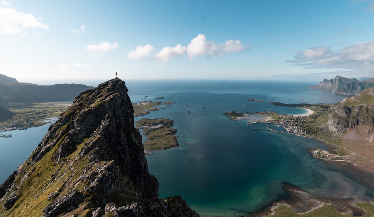
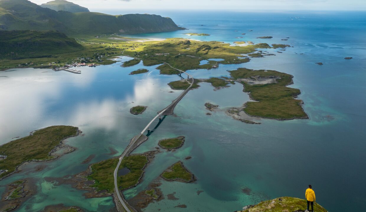
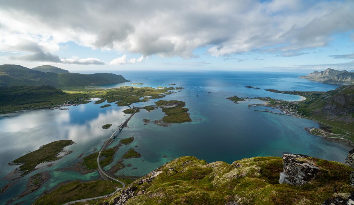
From the summit, hikers are rewarded with stunning views of Skjelfjorden and Selfjorden, as well as a direct overlook of the Fredvang Bridges stretching across the turquoise waters. The dramatic ridge and panoramic seascape make Volandstinden one of Lofoten’s top hiking destinations.
Getting There & Parking – How to Get There and Where to Park
Volandstinden is located in Skjelfjord on Flakstadøya, just a short drive from the E10 highway. When driving on the E10 highway, take the turn off onto Fv807 toward Skjelfjord and follow the road for about 3 km until you reach an orange fishery building, which marks the parking area.
Click here to find the parking lot on Google Maps.
- Distance from Leknes: Approximately 33km (35-minute drive)
- Distance from Svolvær: Approximately 98 km (1 hour 40-minute drive)
- Distance from Reine: Approximately 24km (30-minute drive)
Trailhead – How to Find the Start of the Hike
From the Skjelfjord parking area, look for a large boulder near the base of the hill. The trail starts just to the left of this boulder. A worn footpath leads through a fence gate (be sure to close it behind you) and gently ascends through grassy meadows. Initially, the trail follows a set of power lines up the hill, making navigation easy.
Hike Overview – What to Expect on the Hike
The trail begins with a gentle uphill walk through grassy terrain, offering early views of Skjelfjord. After about 10–15 minutes, you’ll cross a small stream before reaching a wooden wind shelter – a great spot to pause and enjoy the fjord views.
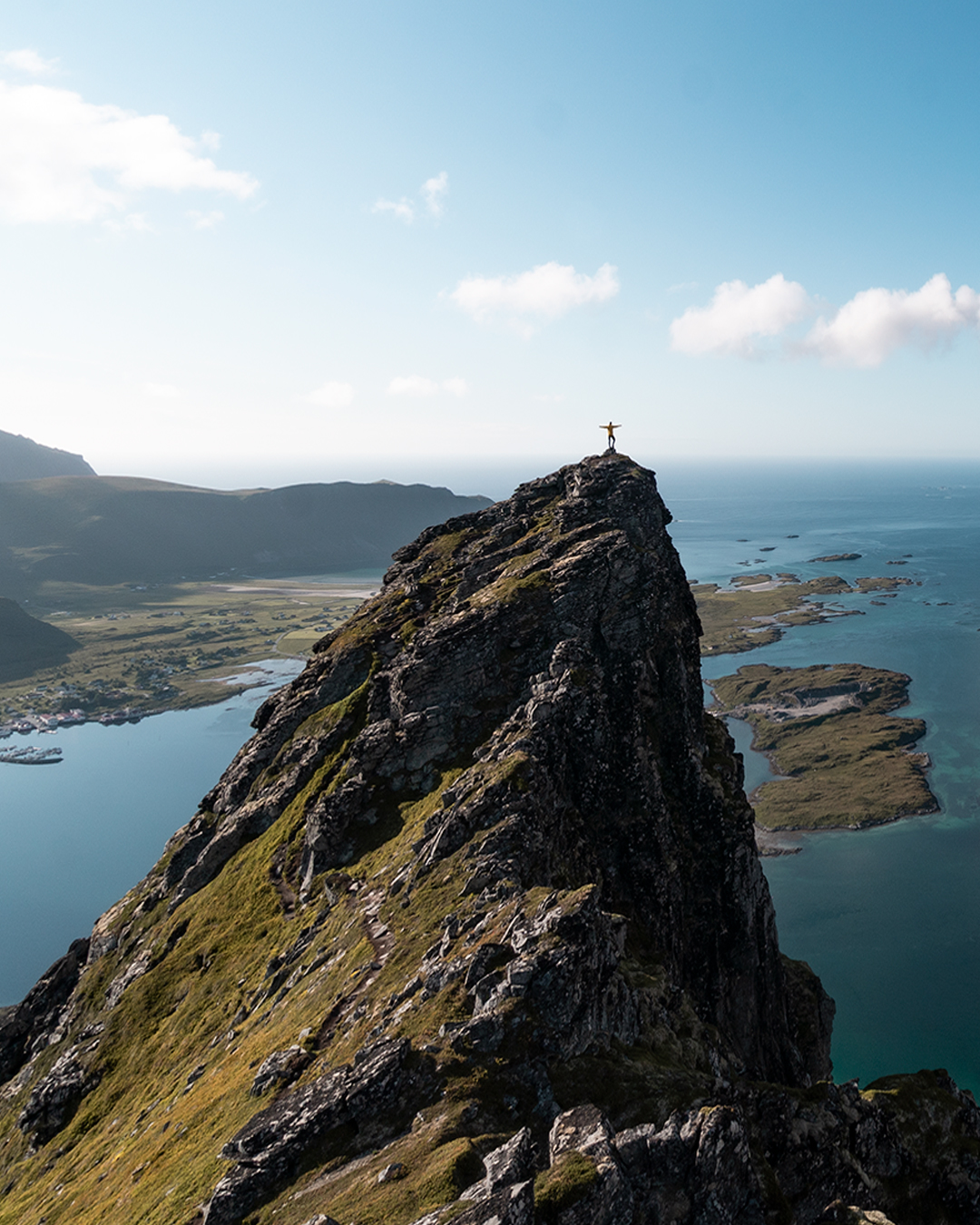
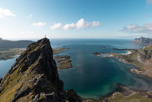
Beyond the shelter, the trail zigzags up a steeper slope. This part includes rocky steps and some light scrambling but remains manageable. Take your time and turn around occasionally – the views of Skjelfjord improve with every step.
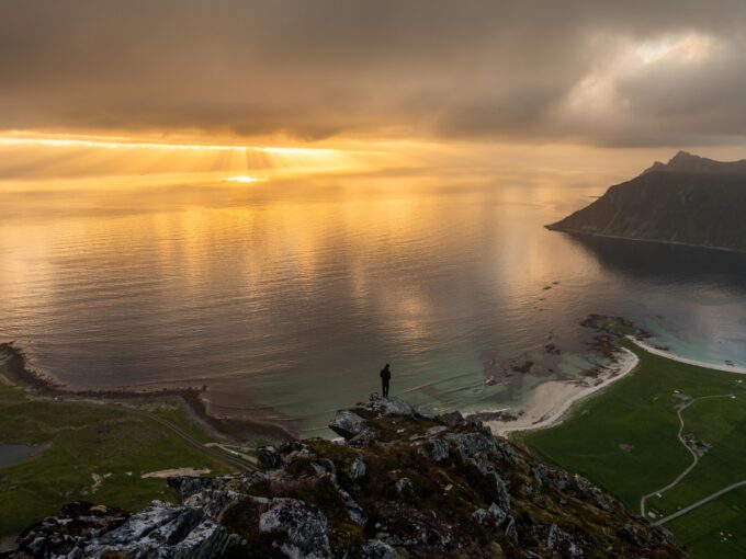
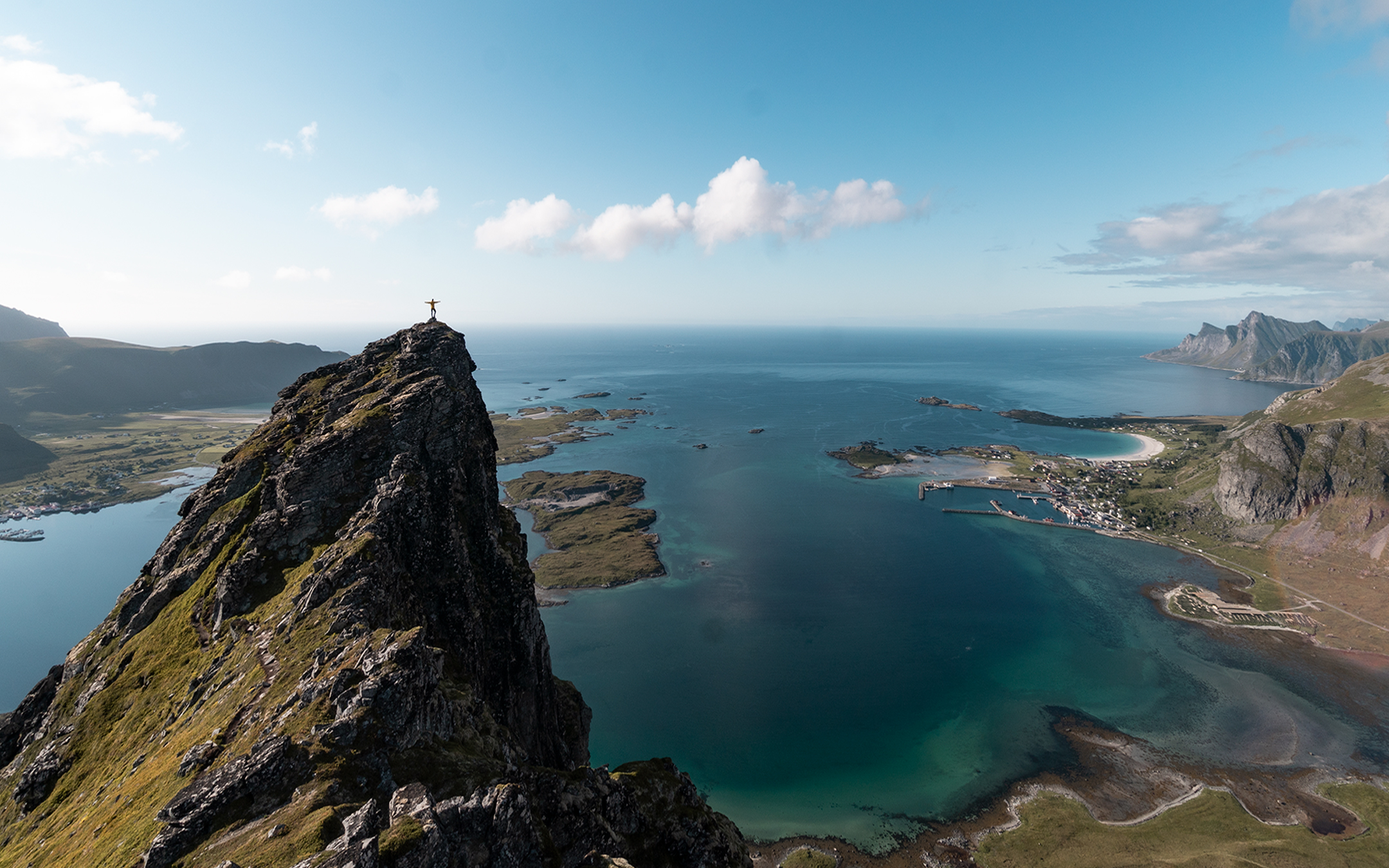
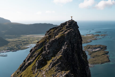
Upon reaching the ridgeline, turn right and follow the well-worn path toward the summit. The terrain here is rocky but not exposed. The summit cairn marks the highest point, where you’ll be rewarded with jaw-dropping views of Selfjorden, Skjelfjorden, and the Fredvang Bridges.
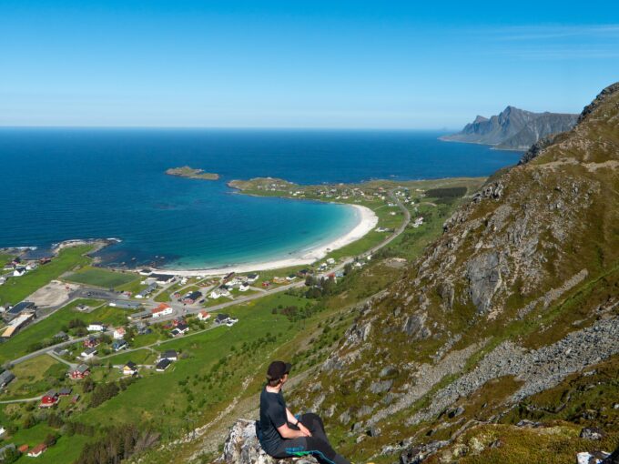
A secondary peak just beyond the summit offers an even more better view of the coastline and the Fredvang Bridges.
Hike Map – GPX Route and Elevation Profile
Weather Forecast – Check the Weather Before You Hike

GPX Note
Please note that the GPX files provided are not 100% precise. They should be used as a general reference for guidance and not as the sole source of navigation. Always ensure to stay aware of your surroundings to ensure your safety while hiking.