Your guide to hiking in Lofoten
Your guide to hiking in Lofoten
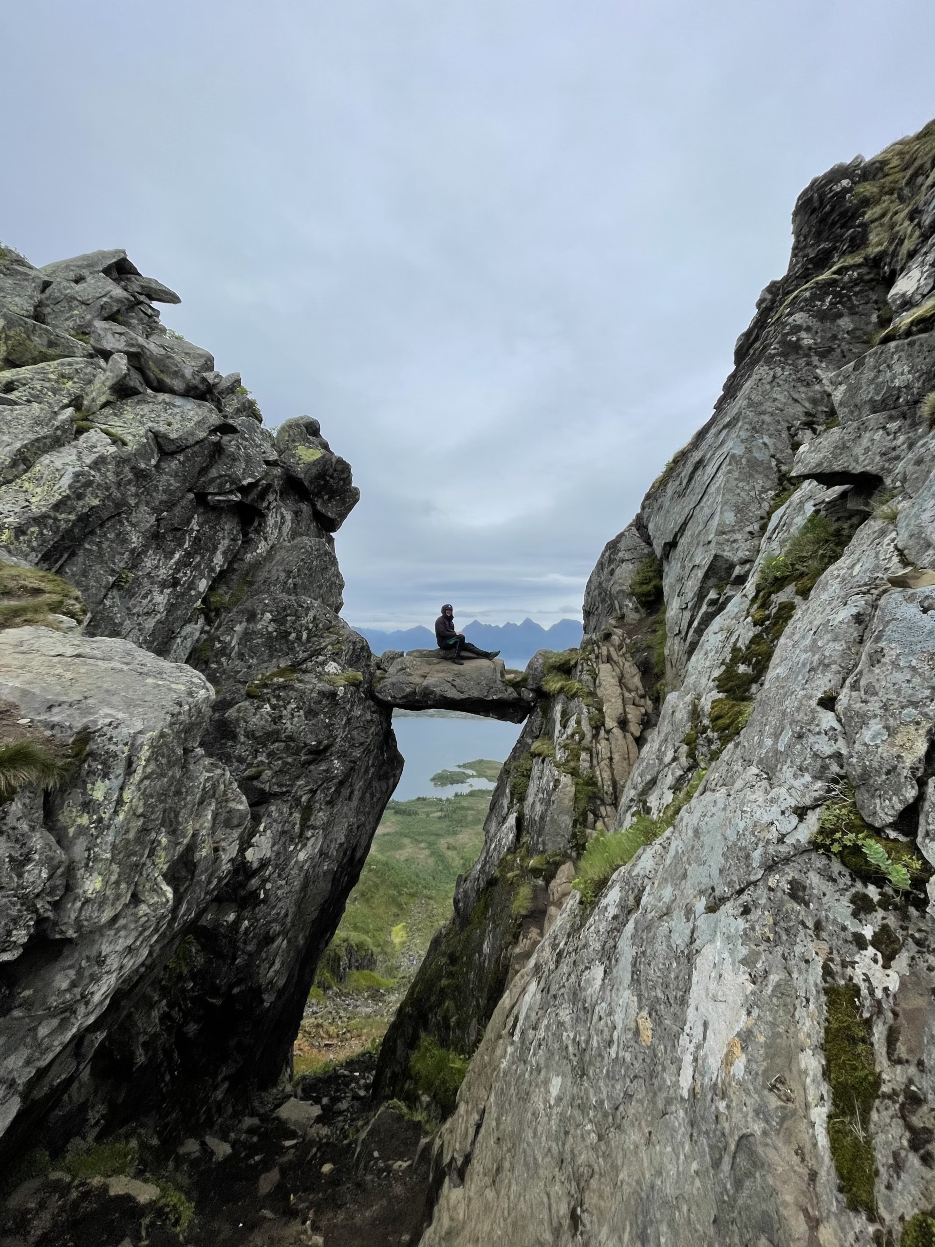
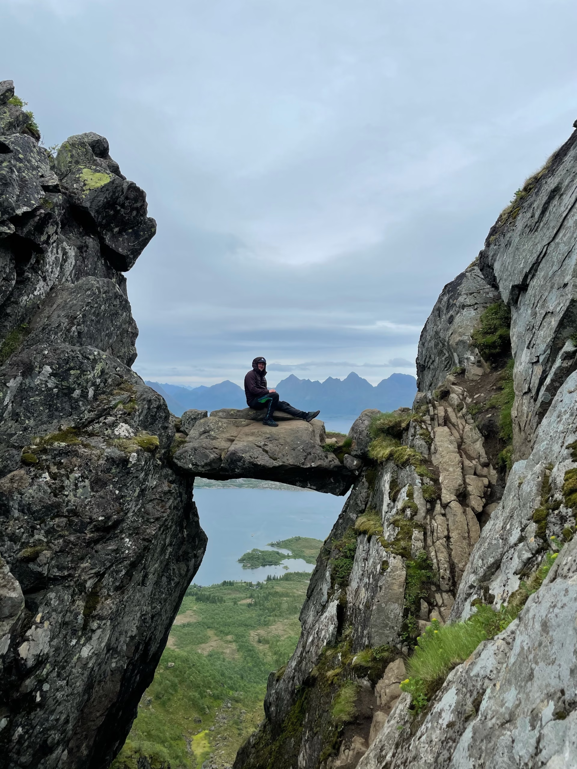
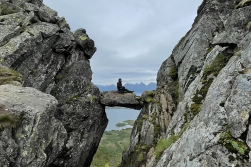
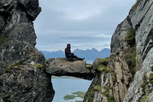
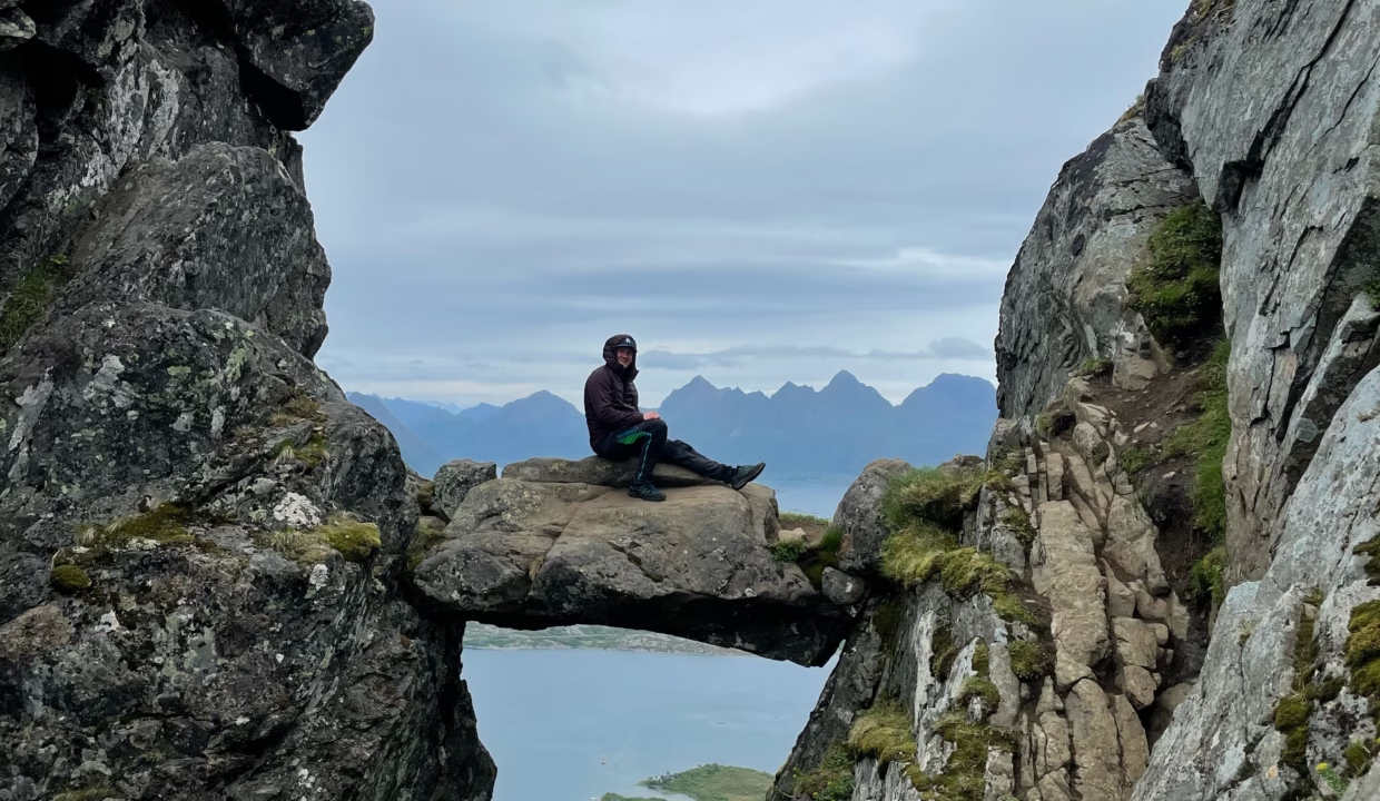
Djevelporten 440m
Medium

About This Hike – A Short Introduction
Djevelporten (“The Devil’s Gate”) is one of the most famous landmarks in Svolvær, Lofoten. This massive boulder is wedged between two towering cliffs, creating a dramatic and unique sight that attracts hikers and photographers alike.
The hike to Djevelporten follows the same trail as the route to Fløya, but you do not need to go all the way to the summit if your goal is to visit this remarkable rock formation.
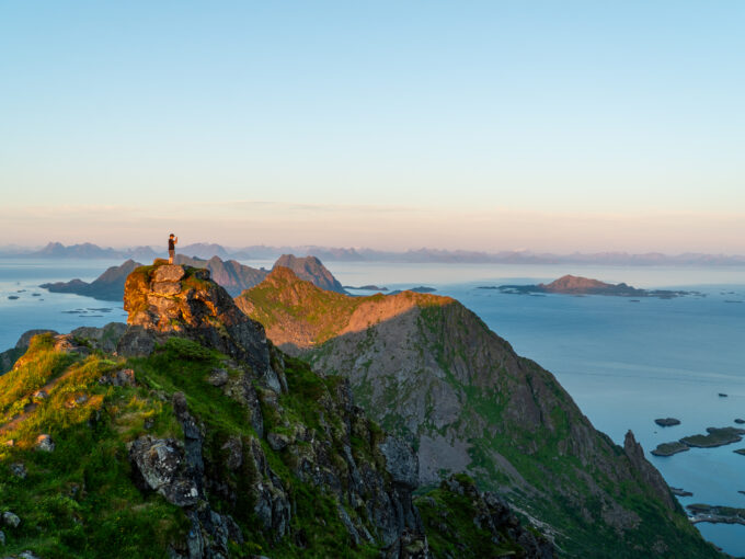
The trail is steep and can be challenging, but thanks to the Sherpa-built stone steps, the ascent is more manageable. The hike offers stunning views over Svolvær and the surrounding fjords, making it one of the most rewarding short hikes in Lofoten.
Getting There & Parking – How to Get There and Where to Park
The hike to Djevelporten starts from the same location as the Fløya trail. The trailhead is just outside the center of Svolvær, at the end of Blåtindveien. Here, you will find a small parking lot behind Svolvær Barnehage (kindergarten). Parking is paid, and spaces fill up quickly, especially during peak season. To secure a spot, it is best to arrive early in the morning. If the parking lot is full, an alternative is to park in Svolvær town center and walk to the trailhead.
For those without a car, it is possible to reach the starting point by foot from Svolvær. The walk from the harbor or ferry terminal takes about 30–45 minutes.
Click here to find the parking lot on Google Maps.
- Distance from Leknes: Approximately 70 km (1-hour 10-minute drive)
- Distance from Svolvær: Approximately 1 km (4-minute drive)
- Distance from Reine: Approximately 120 km (2-hour 5-minute drive)
Trailhead – How to Find the Start of the Hike
The trailhead is located right at the parking lot behind Svolvær Barnehage. Look for the wooden information board marking the entrance to the trail. A well-trodden path leads into the forest, and within minutes, you will reach the Sherpa-built stone staircase known as Djeveltrappa (“The Devil’s Staircase”). This section makes the initial steep climb much easier and is a clear indicator that you are on the right track.
The trail is well-marked with blue-and-white painted signs on rocks, and there are signposts at key junctions. During peak season, you will likely see other hikers, making navigation even easier.
Hike Overview – What to Expect on the Hike
The hike begins with a steep ascent via Djeveltrappa, a Sherpa-built staircase that make the initial climb easier to navigate. The steps wind through shrubs and rocky terrain, quickly gaining altitude. Along the way, there are several benches and viewpoints where you can take a break and enjoy panoramic views of Svolvær and its harbor below. The staircase ends at a small plateau where the terrain briefly levels out, providing a welcome rest before the next ascent.
Beyond the plateau, the trail continues along a dirt-and-rock path with a gentler incline, leading into a wide valley. Here, a wooden boardwalk helps hikers cross marshy terrain, with the mountainsides of Fløya and Frosken (“The Frog”) rising on either side. As the climb resumes, the valley narrows into a rocky gully, and the terrain becomes steeper and more technical.
At the top of this gully, Djevelporten reveals itself—a large, flat boulder precariously wedged between two towering cliffs. The final approach to the rock formation is steep and exposed, requiring careful footing. Handholds and additional stone steps have been placed to assist hikers. Once at Djevelporten, you can carefully step onto the boulder for a dramatic photo, but extreme caution is advised, as there are sheer drops on either side.
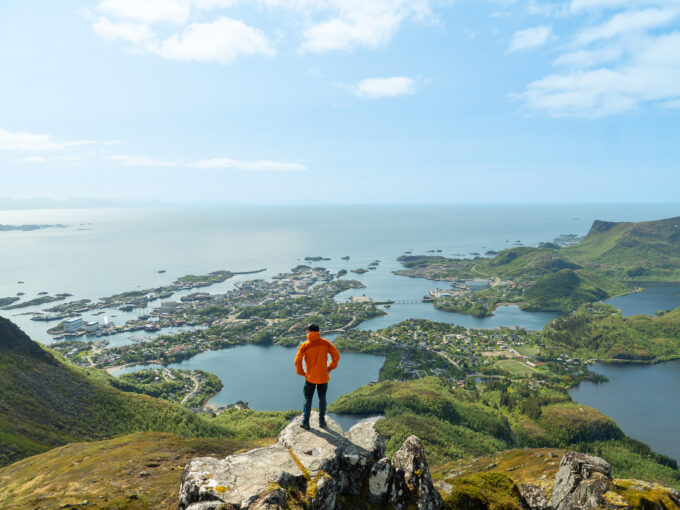
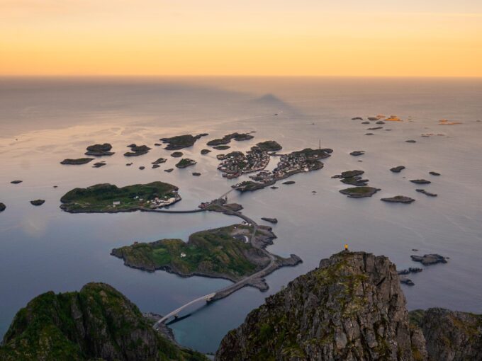
From this vantage point, you are rewarded with breathtaking views over Svolvær, the Lofoten archipelago, and the surrounding fjords. After taking in the scenery, you can either return the same way or continue toward Fløya, which is only 25-30 minutes further for those seeking a greater challenge and even more spectacular views.
Hike Map – GPX Route and Elevation Profile
Weather Forecast – Check the Weather Before You Hike

GPX Note
Please note that the GPX files provided are not 100% precise. They should be used as a general reference for guidance and not as the sole source of navigation. Always ensure to stay aware of your surroundings to ensure your safety while hiking.