Your guide to hiking in Lofoten
Your guide to hiking in Lofoten
Holandsmælen (434m)
Medium


About This Hike – A Short Introduction
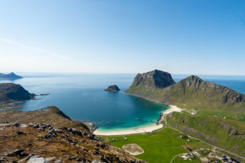
Holandsmælen, standing at 434 meters above sea level, is an relativity easy but very rewarding hike on Vestvågøy in the Lofoten Islands. The 5–6 km round-trip trail takes approximately 2 to 3 hours to complete. The well-defined path gradually ascends the hillside, leading to a broad summit with stunning 360° views. From the top, hikers can admire the white sandy beaches of Haukland and Vik, the deep blue Atlantic Ocean, and the mountain peaks of Lofoten stretching into the distance. With no technical sections and only a few steeper parts, Holandsmælen is ideal for beginners, families, or anyone seeking a breathtaking yet accessible hike.
Getting There & Parking – How to Get There and Where to Park
Holandsmælen is located northwest of Leknes on Vestvågøy. To get there, drive along the E10 highway and turn onto the road leading to Utakleiv Beach. After driving for about 4–5 km, look for a gravel parking area on the right-hand side of the road. The parking is free, but space is limited, so arriving early is recommended, especially during peak season. The summit of Holandsmælen is not visible from the parking area, but the trail starts directly from the parking lot and is easy to find.
Click here to find the parking lot on Google Maps.
- Distance from Leknes: Approximately 10 km (15-minute drive)
- Distance from Svolvær: Approximately 70 km (1 hour 15-minute drive)
- Distance from Reine: Approximately 55km (1-hour drive)
Trailhead – How to Find the Start of the Hike
The trail begins directly from the parking area and is well-trodden and clearly visible. From the start, the path ascends gradually through a small birch forest. There are no major junctions or confusing turns—simply follow the main trail upward toward the summit.
Hike Overview – What to Expect on the Hike
The hike to Holandsmælen is straightforward and relatively gentle, following a clear and well-worn path all the way to the summit.
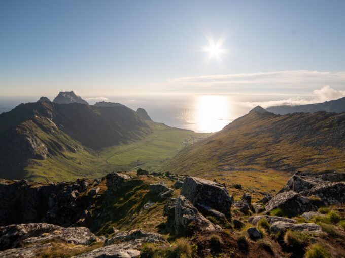
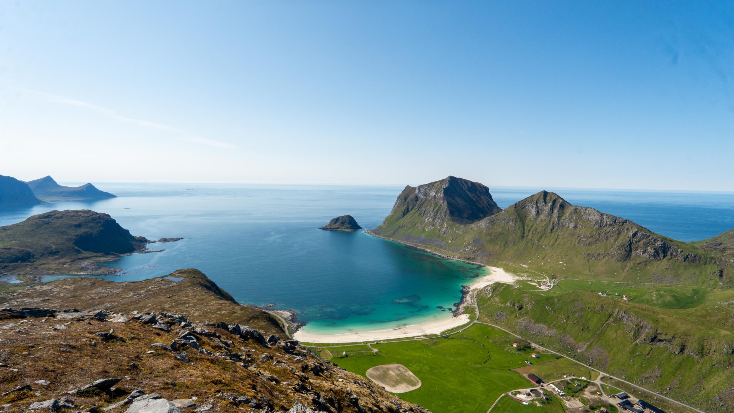
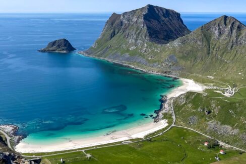
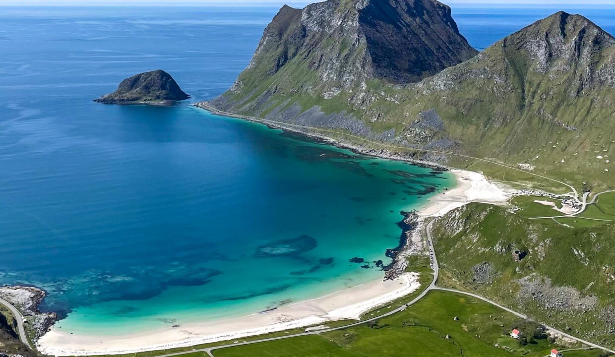
The first section climbs gradually through low birch trees and shrubs, offering glimpses of the coastline through the trees. After about 10–15 minutes, the vegetation becomes sparser, and the trail opens up to a grassy hillside with fantastic views toward the ocean. Here, you’ll get your first view of the stunning white-sand beaches of Vik and Haukland, with their turquoise waters creating a breathtaking contrast against the rugged Lofoten landscape.
After this gentler section, the trail briefly levels out before reaching a short but steeper incline leading up the main slope of Holandsmælen. The path winds its way up through the open landscape, with some boggy sections that can be muddy after rain. To avoid wet ground, it’s best to stay on the most worn sections of the trail.
The final stretch becomes rockier, with a more uneven surface, but no scrambling is required. The last few hundred meters lead up to the flat, broad summit, where a large cairn marks the highest point. The summit is spacious, making it a perfect place to rest, enjoy a snack, and take in the breathtaking surroundings.
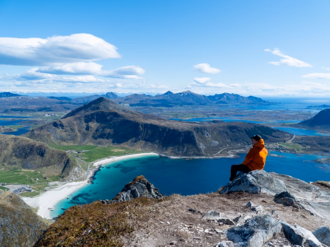
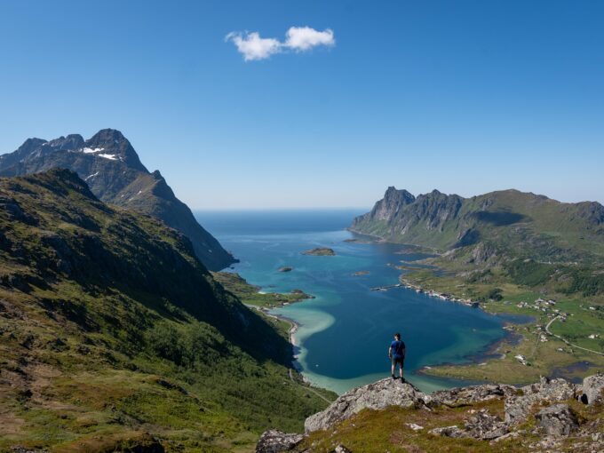
At the top of Holandsmælen, you’ll be rewarded with an incredible 360° panoramic view. To the west, you can look down on the turquoise waters and white sands of Haukland and Vik beaches, which are among the most beautiful in Lofoten. The ocean stretches far into the distance, with the dramatic cliffs and headlands of the coastline adding to the scenery. To the east, you can see the rolling farmland and scattered lakes of Vestvågøy, contrasting sharply with the rugged peaks that rise further north.
Hike Map – GPX Route and Elevation Profile
Weather Forecast – Check the Weather Before You Hike

GPX Note
Please note that the GPX files provided are not 100% precise. They should be used as a general reference for guidance and not as the sole source of navigation. Always ensure to stay aware of your surroundings to ensure your safety while hiking.