Your guide to hiking in Lofoten
Your guide to hiking in Lofoten
Hornet (346m)
Medium


About This Hike – A Short Introduction
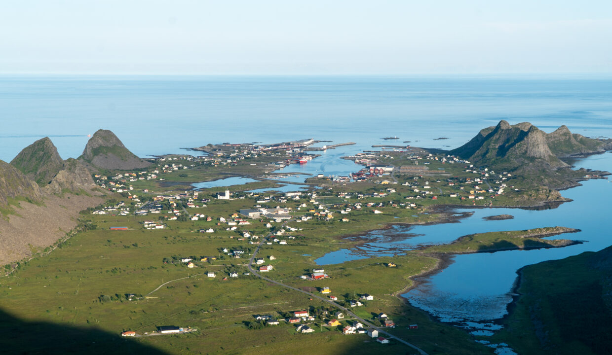
Hornet is one of the best short hikes on Værøy, offering incredible views for relatively little effort. At just 346 meters above sea level, the summit gives you a full 360° panorama over the island – from the steep sea cliffs and the remote coast to the old airport runway and the fishing village of Sørland far below. On clear days, you might even spot the distant mountains of mainland Lofoten.
This is a perfect hike if you’re looking for something quick, scenic, and beginner-friendly. The trail is short but some steep parts, with a clear path and no technical sections. It’s great as a standalone hike or as part of a longer ridge walk to Håen.
Getting There & Parking – How to Get There and Where to Park
Værøy is only reachable by ferry (free from Moskenes or Bodø) or helicopter from Bodø. Once on the island, drive or walk north through the village of Sørland and into the valley called Rømdalen.
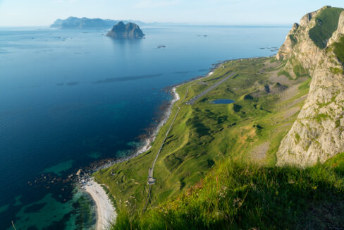
At the end of the road, near a group of blue utility buildings, you’ll find a gravel parking area. This is the starting point for both Hornet and the Håen hike. Parking is free, and you’ll find benches and information signs nearby. This is also where the paved service road (closed to public vehicles) begins up the mountain.
Trailhead – How to Find the Start of the Hike
From the parking area, look for a signposted trail on the left side of the blue building closest to the hill. The trail begins as a grassy path and climbs steadily up the slope, crossing or running alongside the old asphalt road in a few places.
Hike Overview – What to Expect on the Hike
The hike to Hornet is short but rewarding, with a steady climb and fantastic views nearly the entire way. You’ll walk about 1.4 km each way and the trail is clearly visible, follows a natural line up the slope, and doesn’t require any scrambling or climbing. Most hikers will reach the summit in about 45–60 minutes, with plenty of time to stop and enjoy the scenery.
The trail begins with a gentle incline on a grassy footpath, leading up from the blue buildings at the end of the road. Almost immediately, you’ll get views back toward the village of Sørland and the surrounding coastline. As you continue uphill, the trail crosses or runs alongside an old military service road, which is now closed to traffic. In dry weather, both the footpath and road are easy to walk; in wet conditions, some parts can become muddy or slippery — especially where the trail crosses grassy slopes or loose gravel.
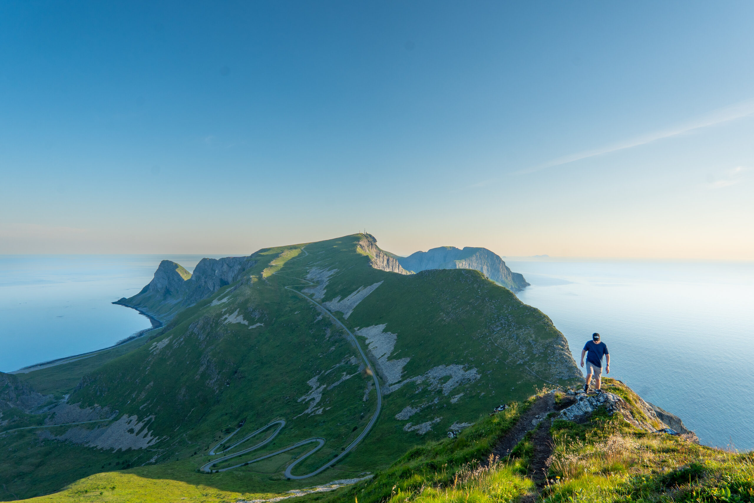
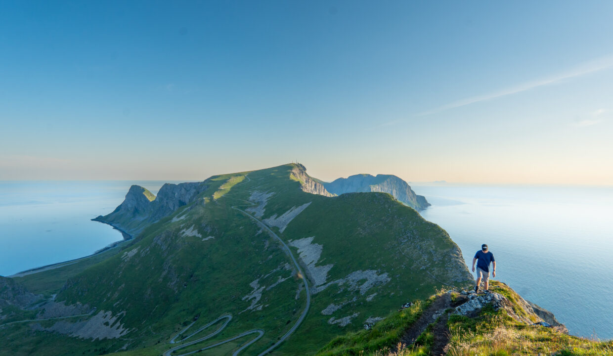
After 30–40 minutes, you’ll reach a saddle on the main ridge of Værøy. This is a good spot to take a short break, as the views open up in both directions. From here, the final stretch to Hornet turns right and follows a narrow ridge trail up to the summit. This part is slightly more exposed — with steep drops on one side — but the path is well-defined, and most hikers will feel comfortable as long as they take care with their footing. In windy weather, it’s smart to go slowly and stay centered on the trail.
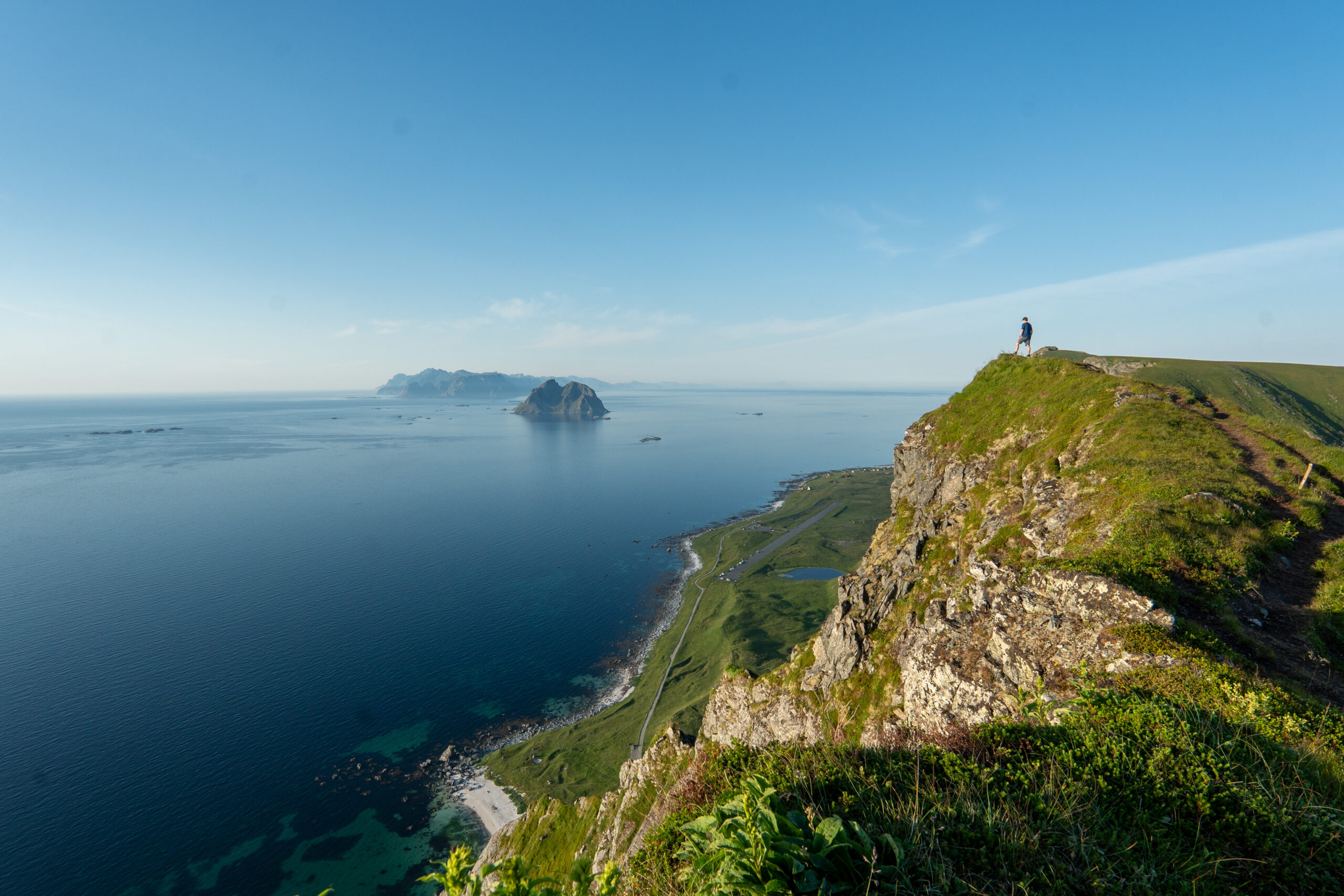
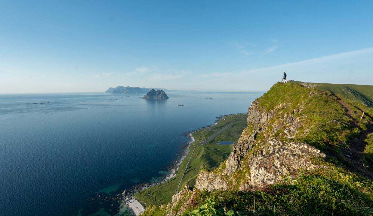
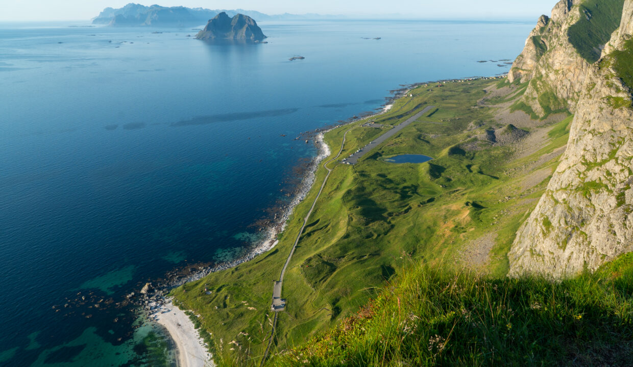
Once you reach the summit of Hornet (346 m), you’ll be greeted by some of the best views anywhere on the island. To the north, you’ll see the old Værøy airstrip, stretching across the flat land near the sea. To the east, the village of Sørland is visible far below, along with the rugged coastline of northern Lofoten. And on a clear day, you might even spot the remote island Mosken and the mountains of Moskenesøya and Flakstadøya in the far distance.
The summit area is open and grassy, with plenty of space to sit, enjoy a snack, or take photos. Be cautious near the edges — there are steep drop-offs in some directions, and wind can be strong at the top. If you’re hiking with children or pets, keep them close.
The return follows the same path back down. The descent is much quicker, but some sections can feel a bit steep on tired legs, so take your time. If you want to make the hike longer, you can also hike to Håen (438 m) — another fantastic viewpoint further along the same ridge.
Overall, Hornet is a great choice for hikers of all levels. It’s short enough for a morning or afternoon trip, but the views are as dramatic as hikes that take twice as long. Perfect for first-time visitors to Værøy or those looking for a rewarding experience without a full-day commitment.
Hike Map – GPX Route and Elevation Profile
Weather Forecast – Check the Weather Before You Hike

GPX Note
Please note that the GPX files provided are not 100% precise. They should be used as a general reference for guidance and not as the sole source of navigation. Always ensure to stay aware of your surroundings to ensure your safety while hiking.