Your guide to hiking in Lofoten
Your guide to hiking in Lofoten
Veggen (489m)
Medium


About This Hike – A Short Introduction
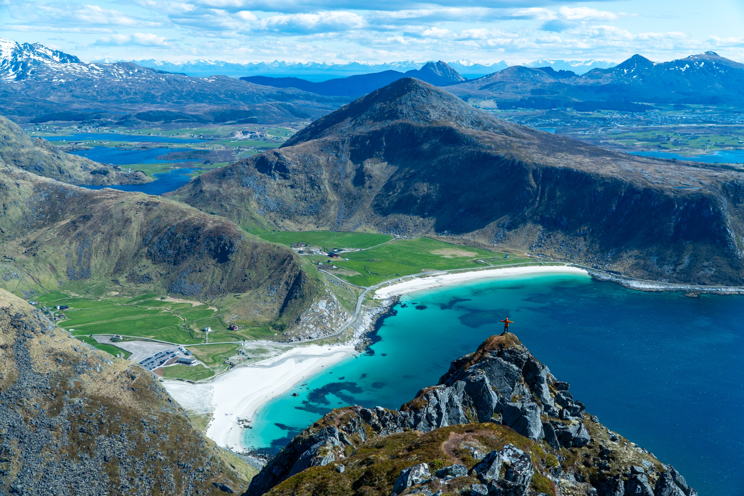
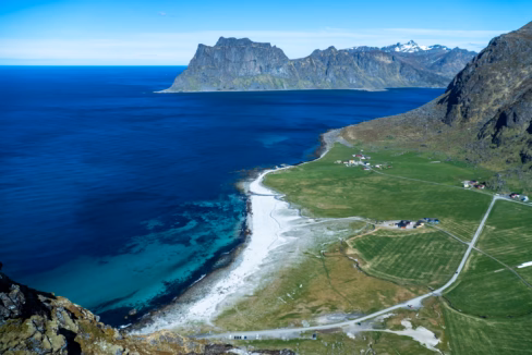
Veggen is one of the most rewarding short hikes in all of Lofoten. Rising 489 meters straight from the coastline, it towers above the white-sand Uttakleiv Beach, offering one of the most iconic summit views in Norway. From the top, you’ll see both Uttakleiv and Haukland Beaches, turquoise waters, jagged mountain peaks, and endless ocean.
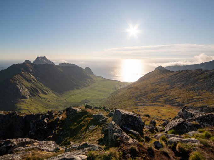
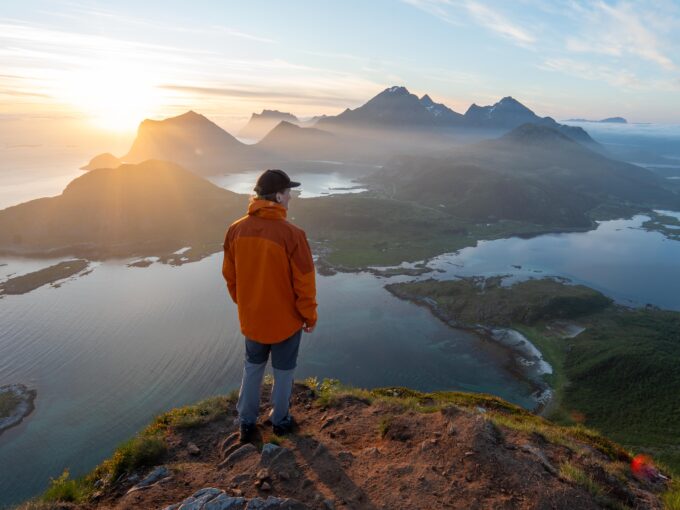
It’s a hike that gives you a real “wow” experience – but doesn’t take a whole day. In summer, it’s especially magical during the midnight sun, when the golden light hangs above the sea late into the night. Veggen is steep, scenic, and unforgettable.
Getting There & Parking – How to Get There and Where to Park
Veggen is located on Vestvågøy Island, just a 15–20 minute drive from Leknes, the nearest town and airport. From Leknes, drive east on the E10, then follow signs to Uttakleiv Beach. The road takes you past Haukland Beach and through a short tunnel. When you exit the tunnel, turn left and continue to the end of the road. There you’ll find a paid parking lot right next to Uttakleiv Beach.
During the summer season, a limited bus service also runs from Leknes to Uttakleiv once or twice daily. This can be a good option if you don’t have a car – just check the latest timetable in advance.
Important: Park at Uttakleiv, not at Haukland, since the trail only starts from the Uttakleiv side. The parking area has basic facilities like toilets (seasonal) and trash bins. In summer, it can also be used by campers and vans.
Click here to find the parking lot on Google Maps.
- Distance from Leknes: Approximately 12 km (18-minute drive)
- Distance from Svolvær: Approximately 75km (1-hour 10-minute drive)
- Distance from Reine: Approximately 60 km (1-hour 8-minute drive)
Trailhead – How to Find the Start of the Hike
After parking at Uttakleiv Beach, look toward the mountain – that’s Veggen, rising sharply above you. The trail starts just before the public toilet building, on the inland (mountain) side of the road.
Follow a small gravel farm road for a few meters, then turn right onto a narrow dirt trail heading uphill. It’s not marked with signs, but the path is visible and well-used. You’ll be heading toward a low mountain pass between two peaks: Mannen on the left, and Veggen on the right.
Hike Overview – What to Expect on the Hike
From the very beginning, the trail climbs steadily up a grassy and rocky slope. The first section is narrow and may be muddy after rain, with some small turns as you zigzag upward. You’ll quickly start gaining elevation, and as you look back, Uttakleiv Beach begins to appear behind you. As you climb higher, you’ll also start seeing Haukland Beach stretching out to the southeast.
After around 100 meters of elevation, you’ll reach a small mountain lake called Vasskarvatnet. This is a great place for a short break. From here, the trail turns right, and the climb becomes noticeably steeper and more challenging. The path remains clear, but your legs will feel the extra effort as the slope increases.
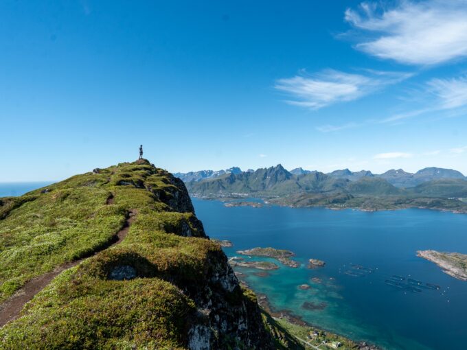
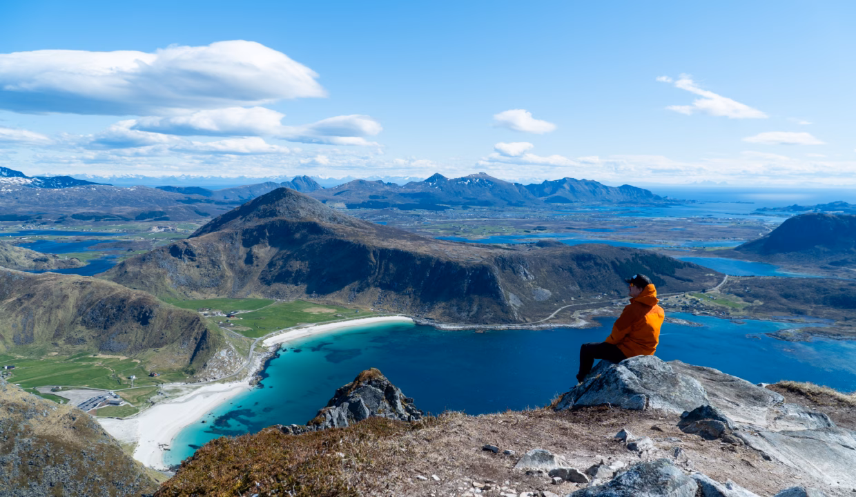
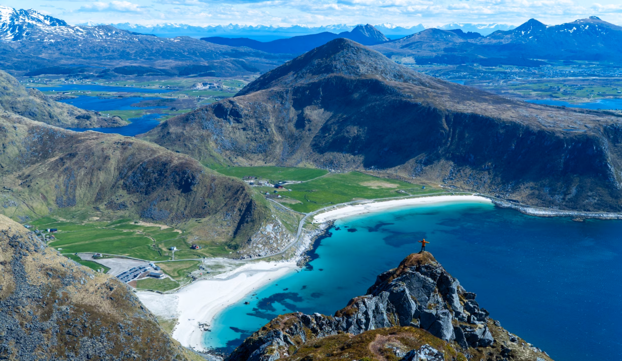
As you approach the top, the trail levels out again. You’ll walk along a wide ridge with patches of grass, rocks, and low mountain plants. The final stretch is more gentle, and the summit soon comes into view. It’s marked with a simple stone cairn.
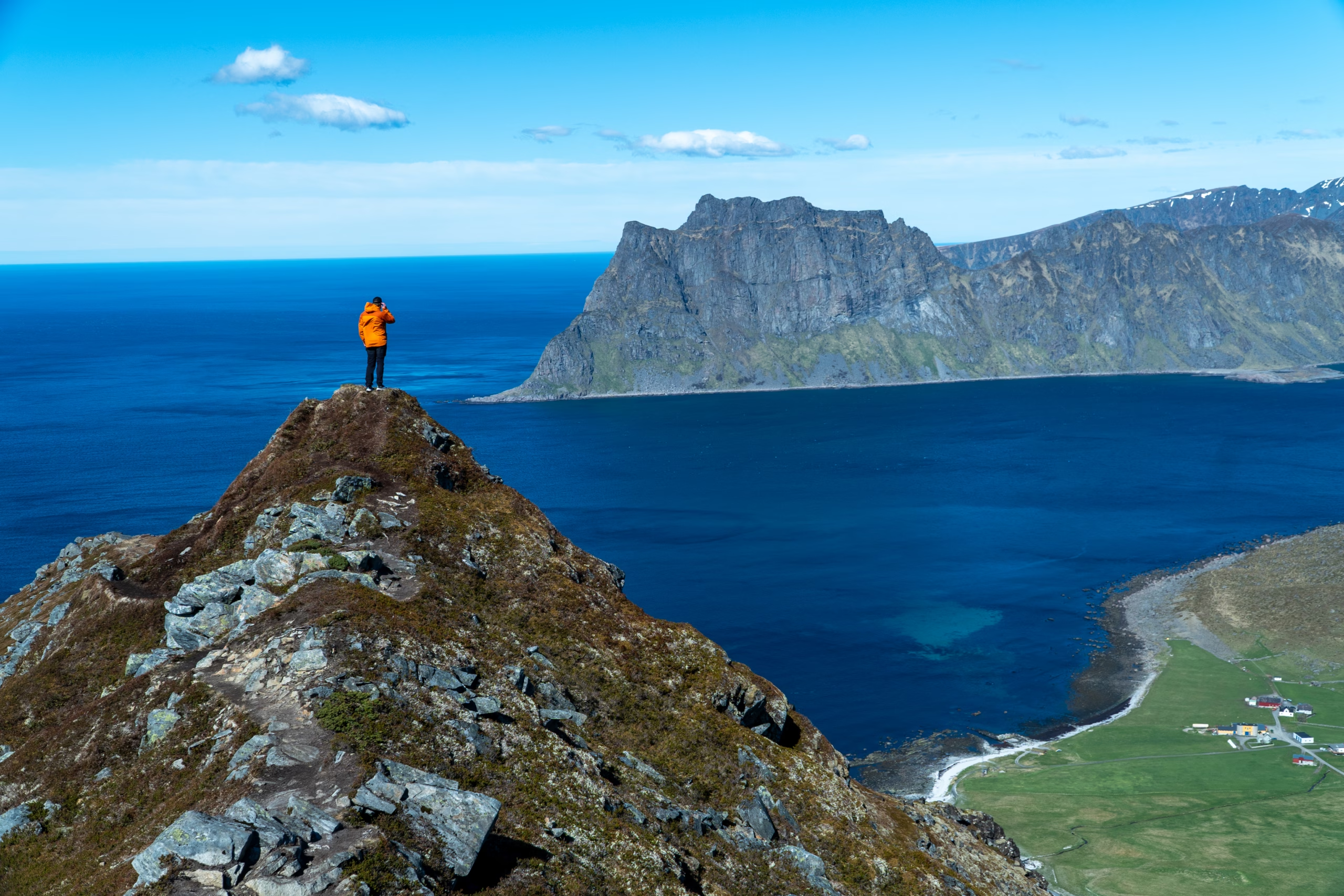
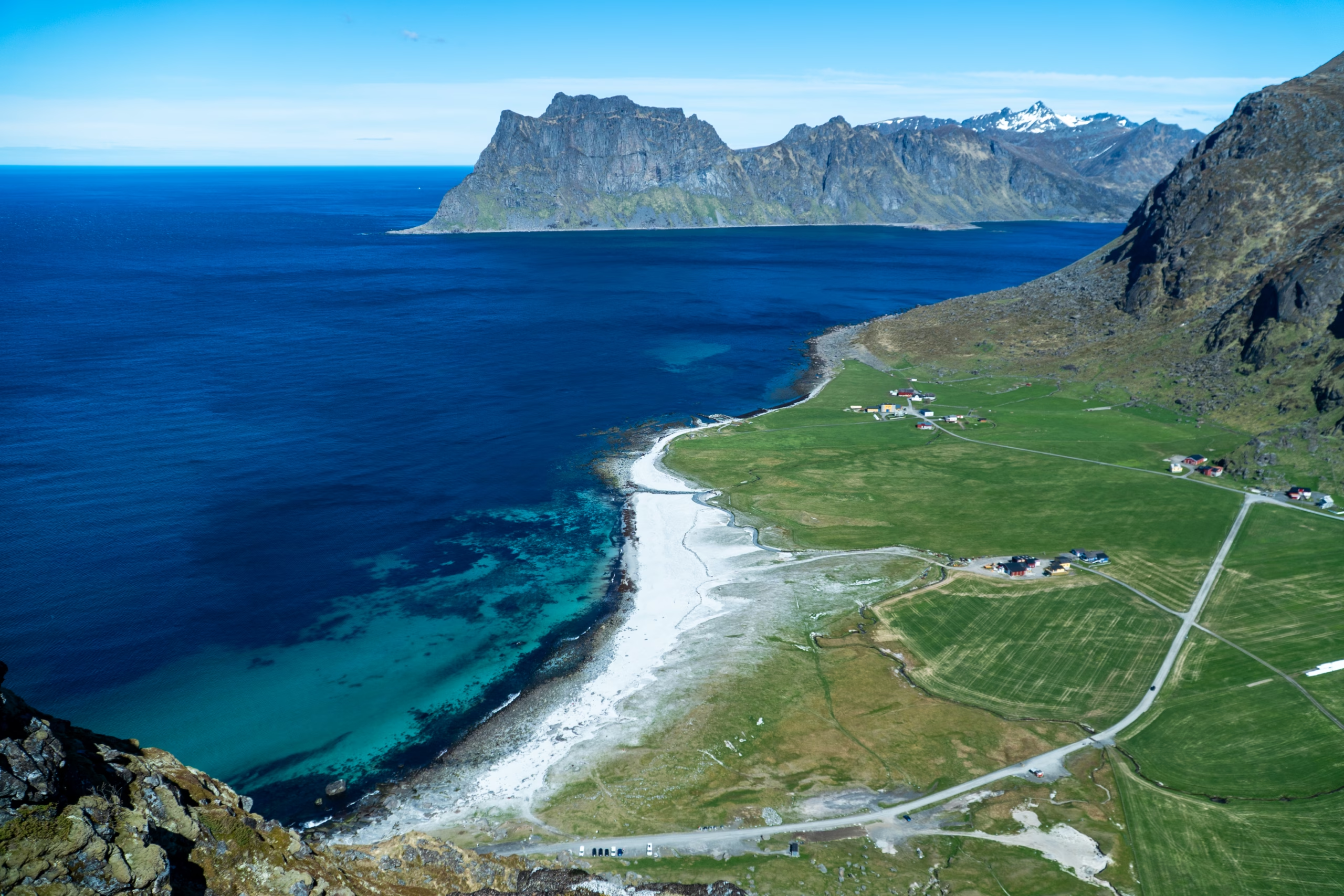
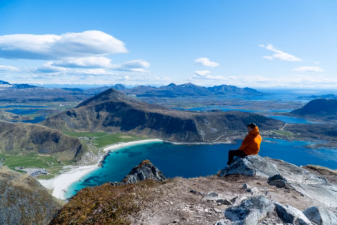
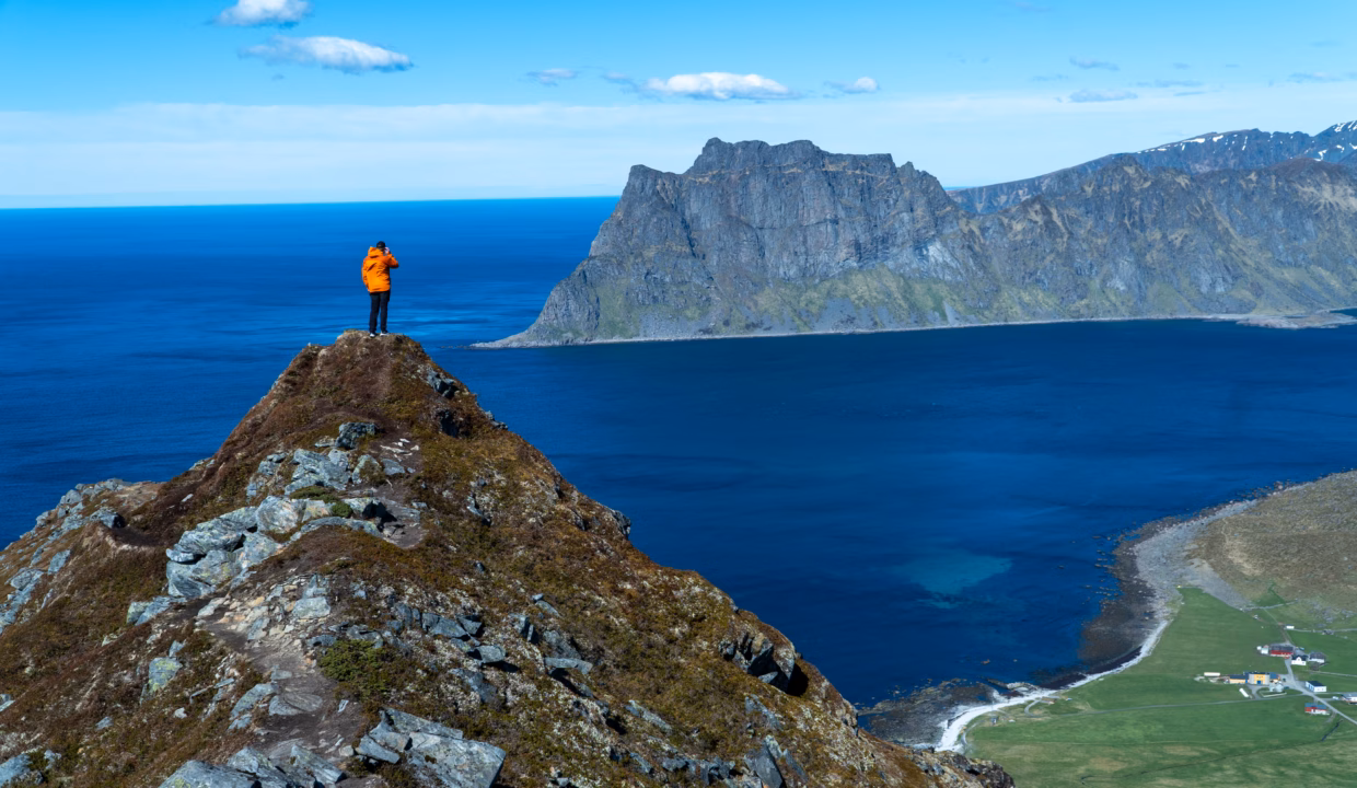
From the top of Veggen, the view is amazing. Behind you is Uttakleiv Beach, right below the cliffs, with its curved shore and deep blue water. In front of you, Haukland Beach stretches out in a long, golden curve, and just past it, you can spot the smaller Vik Beach, hidden in its own little bay. The mix of green mountains, white beaches, and turquoise sea in both directions makes this one of the best views in all of Lofoten.
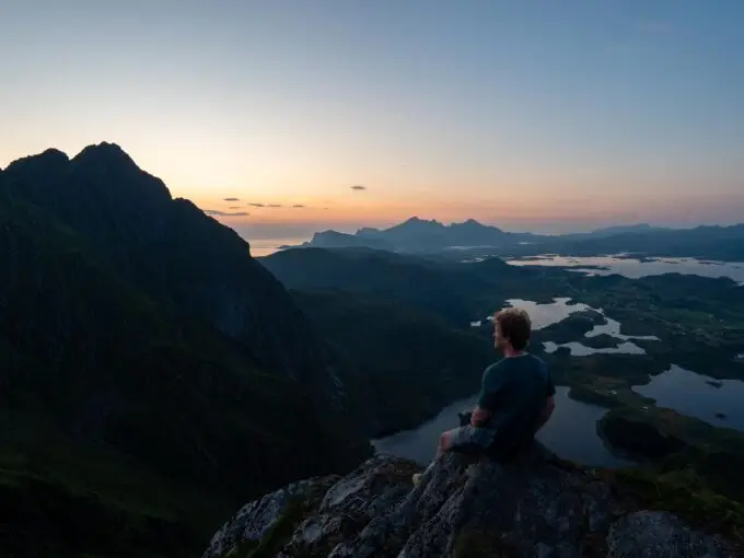
If the weather is clear and calm, especially in the evening during the midnight sun, this spot becomes a truly unforgettable place to relax and take it all in.
Hike Map – GPX Route and Elevation Profile
Weather Forecast – Check the Weather Before You Hike

GPX Note
Please note that the GPX files provided are not 100% precise. They should be used as a general reference for guidance and not as the sole source of navigation. Always ensure to stay aware of your surroundings to ensure your safety while hiking.